Bartlett night lights from space
Night Light of Bartlett (Tennessee) from space (United States) Src. Average luminocity for 10x10km area is 93.6731% and for 50x50km: 53.9531%.
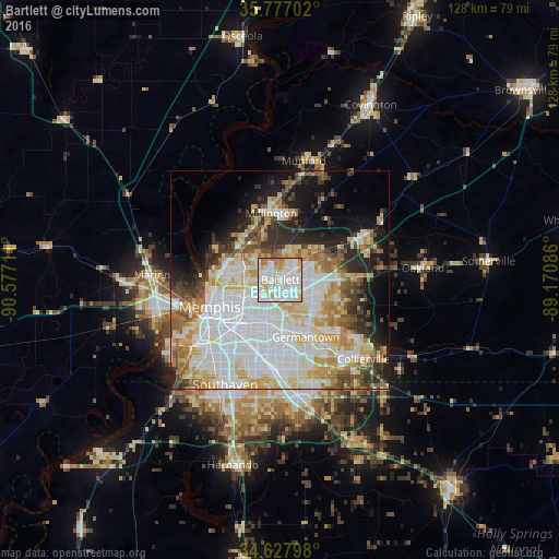

Analysis of Bartlett night lights 2016
Square area 10x10 km:
 40.56%
90-99
36.19%80-89
10.66%70-79
5.94%60-69
6.64%50-59
0%40-49
0%30-39
0%20-29
0%10-19
0%0-9
0%Square area 50x50 km:
18.46%90-99
12.68%80-89
7.44%70-79
6.03%60-69
5.31%50-59
4.4%40-49
3.76%30-39
4.38%20-29
6.54%10-19
9.27%0-9
21.74%Clear (daylight) street map image can be seen on geolist.org.
Map coordinates:
35° 46' 37.3" North, 90° 34' 37.6" West
35° 12' 16.3" North, 89° 52' 26.3" West
34° 37' 40.7" North, 89° 10' 15.1" West
Some cities around Bartlett sort by population:
• Memphis
17 km =10.6 mi,  248°
248°
• New South Memphis
21.2 km =13.2 mi,  231°
231°
• Southaven
27.1 km =16.8 mi,  207°
207°
• Collierville
26.3 km =16.3 mi,  133°
133°
• Germantown
14.3 km =8.9 mi,  156°
156°
• Lakeland
12.5 km =7.8 mi,  76°
76°
• Arlington
21.8 km =13.5 mi,  62°
62°
• Millington
15.4 km =9.6 mi,  352°
352°
4604183 (p: 58,579)
Sources (retrieved 2019-11-25):
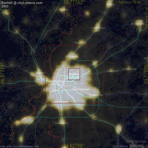
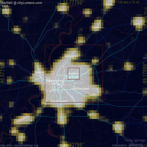
» NASA, Earths city lights 1995
» NASA city lights 2003
» Earth at Night: Flat Maps 2012, 2016