Alma night lights from space
Night Light of Alma (Michigan) from space (United States) Src. Average luminocity for 10x10km area is 23.3698% and for 50x50km: 2.7613%.
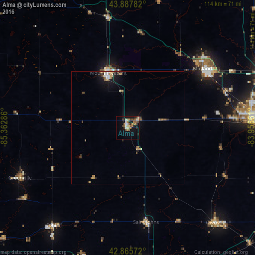
Analysis of Alma night lights 2016
Square area 10x10 km:
 2.38%
2.38%90-99
3.02%80-89
3.17%70-79
2.86%60-69
4.13%50-59
4.13%40-49
4.44%30-39
2.54%20-29
3.97%10-19
17.78%0-9
51.59%Square area 50x50 km:
0.24%90-99
0.32%80-89
0.5%70-79
0.38%60-69
0.36%50-59
0.4%40-49
0.28%30-39
0.35%20-29
0.56%10-19
2.07%0-9
94.54%Clear (daylight) street map image can be seen on geolist.org.
Map coordinates:
43° 53' 16.2" North, 85° 21' 46.3" West
43° 22' 44.1" North, 84° 39' 35" West
42° 51' 56.6" North, 83° 57' 23.8" West
Some cities around Alma sort by population:
• Midland
42.4 km =26.3 mi,  51°
51°
• Mount Pleasant
25.8 km =16 mi,  340°
340°
• Greenville
53 km =32.9 mi,  244°
244°
• Saint Johns
42.8 km =26.6 mi,  169°
169°
• Saint Louis
5.4 km =3.4 mi, 52°
• Freeland
46.3 km =28.8 mi,  69°
69°
• Shields
48.9 km =30.4 mi,  85°
85°
• New Haven
51.9 km =32.2 mi,  127°
127°
4984049 (p: 9,193)
Sources (retrieved 2019-11-25):
» Earth at Night: Flat Maps 2012, 2016