New Haven night lights from space
Night Light of New Haven (Michigan) from space (United States) Src. Average luminocity for 10x10km area is 0.7364% and for 50x50km: 2.8727%.
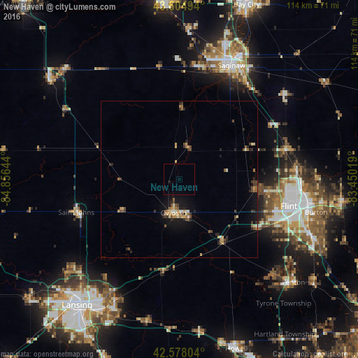
Analysis of New Haven night lights 2016
Square area 10x10 km:
 0%
0%90-99
0%80-89
0%70-79
0%60-69
0%50-59
0%40-49
0%30-39
0%20-29
0.61%10-19
0%0-9
99.39%Square area 50x50 km:
0.11%90-99
0.23%80-89
0.41%70-79
0.46%60-69
0.41%50-59
0.46%40-49
0.58%30-39
0.43%20-29
0.83%10-19
1.75%0-9
94.34%Clear (daylight) street map image can be seen on geolist.org.
Map coordinates:
43° 36' 17.8" North, 84° 51' 23.2" West
43° 5' 37.1" North, 84° 9' 11.9" West
42° 34' 40.9" North, 83° 27' 0.7" West
Some cities around New Haven sort by population:
• Flint
38.9 km =24.2 mi,  103°
103°
• Owosso
10.8 km =6.7 mi,  190°
190°
• Beecher
37.3 km =23.2 mi,  90°
90°
• Flushing
24.8 km =15.4 mi, 97°
• Saint Johns
34.5 km =21.4 mi,  252°
252°
• Bridgeport
36.9 km =22.9 mi,  36°
36°
• Shields
36.6 km =22.7 mi,  12°
12°
• Swartz Creek
30.3 km =18.8 mi,  120°
120°
5003384 (p: 5,123)
Sources (retrieved 2019-11-25):
» Earth at Night: Flat Maps 2012, 2016