Vysokyy night lights from space
Night Light of Vysokyy (Kharkiv) from space (Ukraine) Src. Average luminocity for 10x10km area is 3.1975% and for 50x50km: 8.7715%.
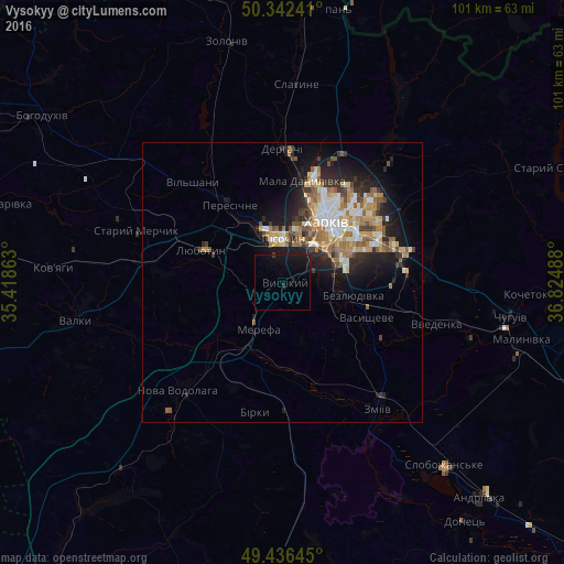
Analysis of Vysokyy night lights 2016
Square area 10x10 km:
 0%
0%90-99
0%80-89
0%70-79
0%60-69
0%50-59
0%40-49
0%30-39
0.28%20-29
0.56%10-19
10.92%0-9
88.24%Square area 50x50 km:
1.16%90-99
1.57%80-89
0.95%70-79
1.35%60-69
1.61%50-59
1.25%40-49
1%30-39
1.01%20-29
2.4%10-19
5.4%0-9
82.3%Clear (daylight) street map image can be seen on geolist.org.
Map coordinates:
50° 20' 32.7" North, 35° 25' 7.1" East
49° 53' 29.6" North, 36° 7' 18.3" East
49° 26' 11.2" North, 36° 49' 29.6" East
Some cities around Vysokyy sort by population:
• Kharkiv
13.7 km =8.5 mi,  43°
43°
• Merefa
9.2 km =5.7 mi,  213°
213°
• Lyubotyn
15.1 km =9.4 mi,  294°
294°
• Solonytsivka
13.3 km =8.3 mi,  331°
331°
• Pokotylivka
4.5 km =2.8 mi,  57°
57°
• Bezlyudivka
10.4 km =6.5 mi,  99°
99°
• Pivdenne
4 km =2.5 mi,  256°
256°
• Budy
7.2 km =4.5 mi,  269°
269°
688696 (p: 10,988)
Sources (retrieved 2019-11-25):
» Earth at Night: Flat Maps 2012, 2016