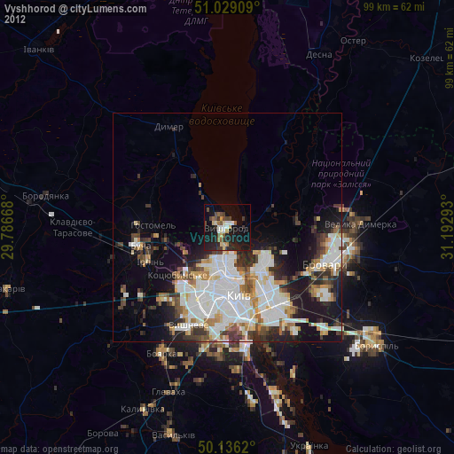
Vyshhorod night lights from space
Night Light of Vyshhorod (Kyiv) from space (Ukraine) Src. Average luminocity for 10x10km area is 26.4599% and for 50x50km: 25.1582%.
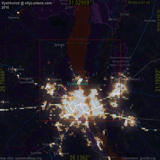
Analysis of Vyshhorod night lights 2016
Square area 10x10 km:
 2.27%
2.27%90-99
3.61%80-89
1.07%70-79
3.07%60-69
1.6%50-59
4.14%40-49
4.95%30-39
6.28%20-29
18.32%10-19
28.61%0-9
26.07%Square area 50x50 km:
7.46%90-99
5.59%80-89
1.8%70-79
2.38%60-69
2.36%50-59
2.47%40-49
2.87%30-39
3.52%20-29
5.81%10-19
11.75%0-9
53.98%Clear (daylight) street map image can be seen on geolist.org.
Map coordinates:
51° 1' 44.7" North, 29° 47' 12" East
50° 35' 5.1" North, 30° 29' 23.3" East
50° 8' 10.3" North, 31° 11' 34.5" East
Some cities around Vyshhorod sort by population:
• Kyiv
14.7 km =9.1 mi,  170°
170°
• Bucha
20.2 km =12.6 mi,  256°
256°
• Irpin
18.3 km =11.4 mi,  247°
247°
• Kotsyubyns’ke
15.6 km =9.7 mi,  226°
226°
• Hostomel
16 km =9.9 mi, 263°
• Novi Petrivtsi
5.8 km =3.6 mi,  325°
325°
• Sofiyivska Borschagivka
21.3 km =13.2 mi,  204°
204°
• Horenka
11.5 km =7.1 mi, 254°
688723 (p: 22,080)
Sources (retrieved 2019-11-25):
» Earth at Night: Flat Maps 2012, 2016