Tysmenytsya night lights from space
Night Light of Tysmenytsya (Ivano-Frankivsk) from space (Ukraine) Src. Average luminocity for 10x10km area is 1.2514% and for 50x50km: 1.7734%.
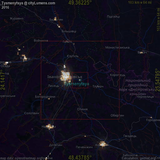
Analysis of Tysmenytsya night lights 2016
Square area 10x10 km:
 0%
0%90-99
0%80-89
0%70-79
0%60-69
0.57%50-59
0%40-49
0%30-39
0%20-29
0%10-19
0.85%0-9
98.58%Square area 50x50 km:
0.16%90-99
0.42%80-89
0.24%70-79
0.11%60-69
0.25%50-59
0.18%40-49
0.12%30-39
0.23%20-29
0.31%10-19
1.85%0-9
96.11%Clear (daylight) street map image can be seen on geolist.org.
Map coordinates:
49° 21' 44.1" North, 24° 8' 30.1" East
48° 54' 7.9" North, 24° 50' 41.4" East
48° 26' 16.3" North, 25° 32' 52.6" East
Some cities around Tysmenytsya sort by population:
• Ivano-Frankivsk
10.1 km =6.3 mi,  282°
282°
• Kalush
36.5 km =22.7 mi,  289°
289°
• Nadvirna
35.9 km =22.3 mi,  214°
214°
• Lanchyn
38.8 km =24.1 mi,  189°
189°
• Bohorodchany
24.8 km =15.4 mi,  244°
244°
• Halych
25.9 km =16.1 mi,  340°
340°
• Kosmach
38.8 km =24.1 mi, 244°
• Otyniya
18.3 km =11.4 mi,  176°
176°
690873 (p: 9,426)
Sources (retrieved 2019-11-25):
» Earth at Night: Flat Maps 2012, 2016