Ivano-Frankivsk night lights from space
Night Light of Ivano-Frankivsk from space (Ukraine) Src. Average luminocity for 10x10km area is 36.7514% and for 50x50km: 1.8265%.
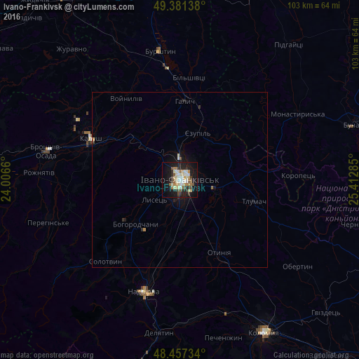
Analysis of Ivano-Frankivsk night lights 2016
Square area 10x10 km:
 3.84%
3.84%90-99
10.23%80-89
5.68%70-79
2.56%60-69
5.4%50-59
4.55%40-49
2.56%30-39
4.83%20-29
6.82%10-19
34.8%0-9
18.75%Square area 50x50 km:
0.16%90-99
0.42%80-89
0.24%70-79
0.12%60-69
0.26%50-59
0.18%40-49
0.12%30-39
0.28%20-29
0.32%10-19
1.89%0-9
96%Clear (daylight) street map image can be seen on geolist.org.
Map coordinates:
49° 22' 53" North, 24° 0' 23.8" East
48° 55' 17.4" North, 24° 42' 35" East
48° 27' 26.4" North, 25° 24' 46.3" East
Some cities around Ivano-Frankivsk sort by population:
• Kalush
26.5 km =16.5 mi,  292°
292°
• Nadvirna
33.5 km =20.8 mi,  197°
197°
• Burshtyn
38 km =23.6 mi,  350°
350°
• Tysmenytsya
10.1 km =6.3 mi,  102°
102°
• Bohorodchany
17.9 km =11.1 mi,  224°
224°
• Halych
22.3 km =13.9 mi,  3°
3°
• Kosmach
31.4 km =19.5 mi,  232°
232°
• Otyniya
23.3 km =14.5 mi,  151°
151°
707471 (p: 204,200)
Sources (retrieved 2019-11-25):
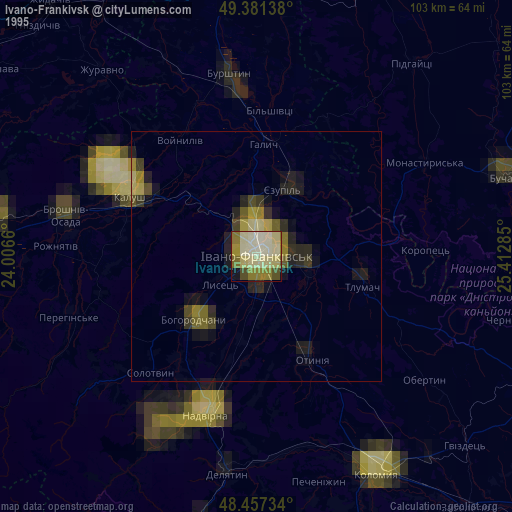
» NASA, Earths city lights 1995
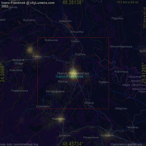
» NASA city lights 2003
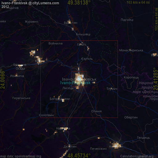
» Earth at Night: Flat Maps 2012, 2016