Staryy Krym night lights from space
Night Light of Staryy Krym (Donetsk) from space (Ukraine) Src. Average luminocity for 10x10km area is 27.6265% and for 50x50km: 6.4845%.
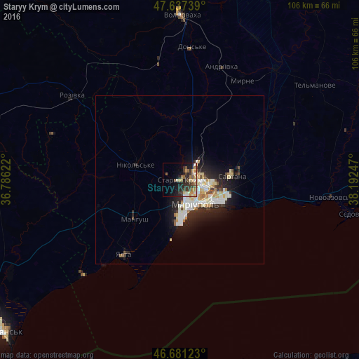
Analysis of Staryy Krym night lights 2016
Square area 10x10 km:
 1.64%
1.64%90-99
4.61%80-89
2.68%70-79
5.65%60-69
4.76%50-59
4.02%40-49
3.27%30-39
8.78%20-29
9.23%10-19
13.39%0-9
41.96%Square area 50x50 km:
0.99%90-99
1.69%80-89
0.85%70-79
0.62%60-69
0.6%50-59
0.49%40-49
0.54%30-39
0.91%20-29
2.31%10-19
4.06%0-9
86.94%Clear (daylight) street map image can be seen on geolist.org.
Map coordinates:
47° 38' 14.6" North, 36° 47' 10.4" East
47° 9' 41.3" North, 37° 29' 21.6" East
46° 40' 52.4" North, 38° 11' 32.9" East
Some cities around Staryy Krym sort by population:
• Mariupol
8.4 km =5.2 mi,  151°
151°
• Dokuchayevs’k
67 km =41.6 mi,  12°
12°
• Volnovakha
48.9 km =30.4 mi,  0°
0°
• Novoazovs'k
45.4 km =28.2 mi,  96°
96°
• Sartana
15.4 km =9.6 mi,  84°
84°
• Manhush
17.9 km =11.1 mi,  229°
229°
• Dolzhanskaya, RU
63.3 km =39.3 mi,  157°
157°
• Yalta
27.5 km =17.1 mi,  216°
216°
692713 (p: 5,977)
Sources (retrieved 2019-11-25):
» Earth at Night: Flat Maps 2012, 2016