Slatyne night lights from space
Night Light of Slatyne (Kharkiv) from space (Ukraine) Src. Average luminocity for 10x10km area is 0.115% and for 50x50km: 4.2467%.
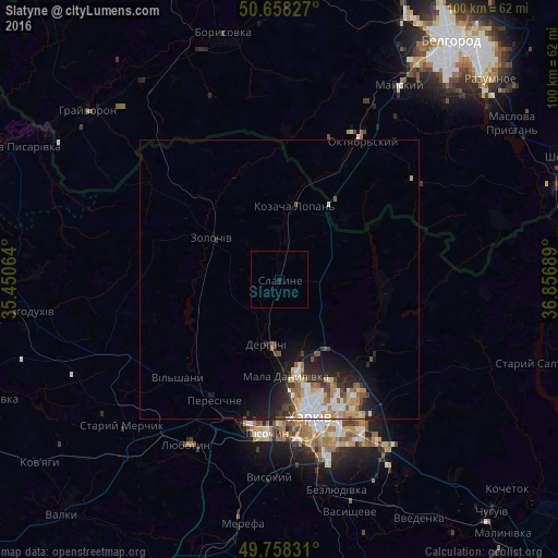
Analysis of Slatyne night lights 2016
Square area 10x10 km:
 0%
0%90-99
0%80-89
0%70-79
0%60-69
0%50-59
0%40-49
0%30-39
0%20-29
0%10-19
0.53%0-9
99.47%Square area 50x50 km:
0.73%90-99
0.79%80-89
0.49%70-79
0.6%60-69
0.52%50-59
0.51%40-49
0.47%30-39
0.57%20-29
1.23%10-19
2.58%0-9
91.52%Clear (daylight) street map image can be seen on geolist.org.
Map coordinates:
50° 39' 29.8" North, 35° 27' 2.3" East
50° 12' 37.5" North, 36° 9' 13.5" East
49° 45' 29.9" North, 36° 51' 24.8" East
Some cities around Slatyne sort by population:
• Kharkiv
26.5 km =16.5 mi,  164°
164°
• Lyubotyn
33.4 km =20.8 mi,  208°
208°
• Derhachi
11.8 km =7.3 mi,  191°
191°
• Solonytsivka
25.2 km =15.7 mi,  199°
199°
• Zolochiv
14.5 km =9 mi,  302°
302°
• Pokotylivka
33.1 km =20.6 mi,  177°
177°
• Mala Danylivka
16.4 km =10.2 mi, 177°
• Peresichna
24.1 km =15 mi, 211°
693598 (p: 6,544)
Sources (retrieved 2019-11-25):
» Earth at Night: Flat Maps 2012, 2016