Simferopol night lights from space
Night Light of Simferopol (Crimea) from space (Ukraine) Src. Average luminocity for 10x10km area is 53.681% and for 50x50km: 3.8036%.
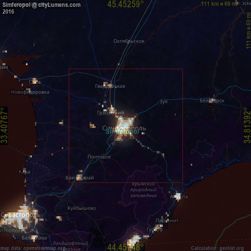
Analysis of Simferopol night lights 2016
Square area 10x10 km:
 7.14%
7.14%90-99
11.9%80-89
8.25%70-79
10.16%60-69
7.46%50-59
10.48%40-49
5.08%30-39
3.65%20-29
17.14%10-19
16.67%0-9
2.06%Square area 50x50 km:
0.34%90-99
0.57%80-89
0.34%70-79
0.49%60-69
0.6%50-59
0.67%40-49
0.59%30-39
0.51%20-29
1.21%10-19
2.79%0-9
91.88%Clear (daylight) street map image can be seen on geolist.org.
Map coordinates:
45° 27' 9.3" North, 33° 24' 27.6" East
44° 57' 25.9" North, 34° 6' 38.8" East
44° 27' 26.9" North, 34° 48' 50.1" East
Some cities around Simferopol sort by population:
• Bakhchysarai
30 km =18.6 mi,  221°
221°
• Hvardiiske
19.1 km =11.9 mi,  338°
338°
• Gresovskiy
8.7 km =5.4 mi,  310°
310°
• Mirnoye
4.8 km =3 mi, 306°
• Molodyozhnoye
6.7 km =4.2 mi,  320°
320°
• Zuya
19.8 km =12.3 mi,  56°
56°
• Pionerskoye
11.1 km =6.9 mi,  139°
139°
• Chisten’koye
9.8 km =6.1 mi,  210°
210°
693805 (p: 336,460)
Sources (retrieved 2019-11-25):
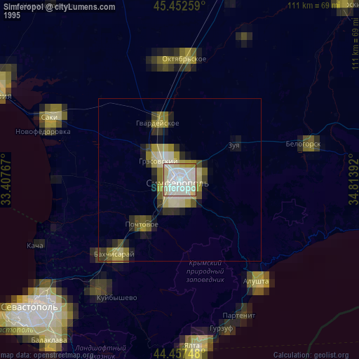
» NASA, Earths city lights 1995
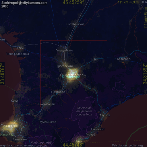
» NASA city lights 2003
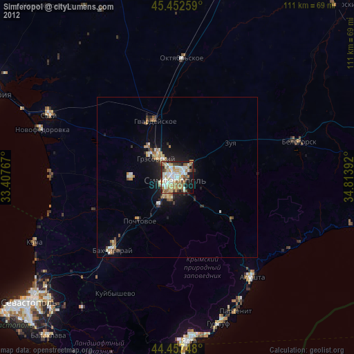
» Earth at Night: Flat Maps 2012, 2016