Rivne night lights from space
Night Light of Rivne (Kirovohrad) from space (Ukraine) Src. Average luminocity for 10x10km area is 0% and for 50x50km: 0.0825%.
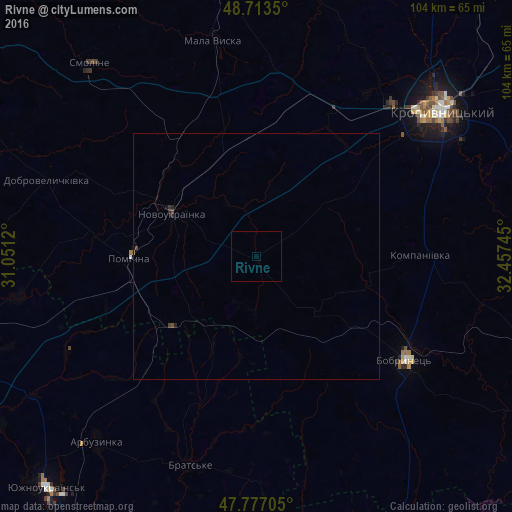
Analysis of Rivne night lights 2016
Square area 10x10 km:
 0%
0%90-99
0%80-89
0%70-79
0%60-69
0%50-59
0%40-49
0%30-39
0%20-29
0%10-19
0%0-9
100%Square area 50x50 km:
0%90-99
0%80-89
0%70-79
0%60-69
0%50-59
0.02%40-49
0.08%30-39
0.02%20-29
0.08%10-19
0.04%0-9
99.76%Clear (daylight) street map image can be seen on geolist.org.
Map coordinates:
48° 42' 48.6" North, 31° 3' 4.3" East
48° 14' 50.7" North, 31° 45' 15.6" East
47° 46' 37.4" North, 32° 27' 26.8" East
Some cities around Rivne sort by population:
• Kropyvnytskyi
47.6 km =29.6 mi,  51°
51°
• Yuzhnoukrains'k
63.9 km =39.7 mi,  221°
221°
• Novoukrayinka
18.9 km =11.7 mi,  297°
297°
• Novomyrhorod
59.9 km =37.2 mi,  352°
352°
• Mala Vyska
44.8 km =27.8 mi, 348°
• Pomichna
25.1 km =15.6 mi,  268°
268°
• Arbuzynka
49.5 km =30.8 mi, 220°
• Novhorodka
68.1 km =42.3 mi,  78°
78°
695365 (p: 5,296)
Sources (retrieved 2019-11-25):
» Earth at Night: Flat Maps 2012, 2016