Pryvillya night lights from space
Night Light of Pryvillya (Luhansk) from space (Ukraine) Src. Average luminocity for 10x10km area is 3.8467% and for 50x50km: 2.299%.
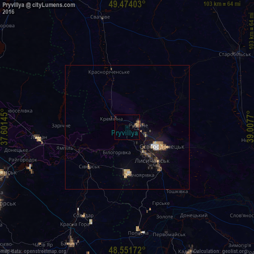
Analysis of Pryvillya night lights 2016
Square area 10x10 km:
 0%
0%90-99
0%80-89
0.74%70-79
0.6%60-69
0.45%50-59
1.34%40-49
1.04%30-39
0.45%20-29
2.38%10-19
0.45%0-9
92.56%Square area 50x50 km:
0.19%90-99
0.17%80-89
0.25%70-79
0.31%60-69
0.31%50-59
0.38%40-49
0.52%30-39
0.25%20-29
0.55%10-19
1.93%0-9
95.15%Clear (daylight) street map image can be seen on geolist.org.
Map coordinates:
49° 28' 26.5" North, 37° 36' 5.2" East
49° 0' 54" North, 38° 18' 16.5" East
48° 33' 6.2" North, 39° 0' 27.7" East
Some cities around Pryvillya sort by population:
• Syevyerodonets’k
15.5 km =9.6 mi,  118°
118°
• Lysychans’k
15.8 km =9.8 mi,  140°
140°
• Rubizhne
5.5 km =3.4 mi,  93°
93°
• Lyman
36.8 km =22.9 mi,  265°
265°
• Kreminna
7.4 km =4.6 mi,  301°
301°
• Sivers’k
22.2 km =13.8 mi,  222°
222°
• Soledar
40.5 km =25.2 mi,  202°
202°
• Hirs’ke
34.2 km =21.3 mi,  155°
155°
696218 (p: 8,669)
Sources (retrieved 2019-11-25):
» Earth at Night: Flat Maps 2012, 2016