Lysychans’k night lights from space
Night Light of Lysychans’k (Luhansk) from space (Ukraine) Src. Average luminocity for 10x10km area is 23.8906% and for 50x50km: 2.2715%.
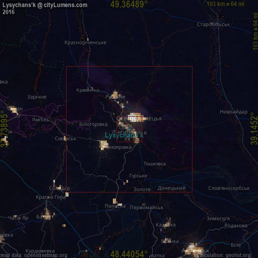
Analysis of Lysychans’k night lights 2016
Square area 10x10 km:
 2.98%
2.98%90-99
2.41%80-89
1.42%70-79
1.85%60-69
2.56%50-59
4.83%40-49
7.39%30-39
3.27%20-29
7.53%10-19
26.85%0-9
38.92%Square area 50x50 km:
0.19%90-99
0.16%80-89
0.25%70-79
0.33%60-69
0.29%50-59
0.35%40-49
0.54%30-39
0.22%20-29
0.53%10-19
1.91%0-9
95.23%Clear (daylight) street map image can be seen on geolist.org.
Map coordinates:
49° 21' 53.6" North, 37° 44' 20.2" East
48° 54' 17.5" North, 38° 26' 31.5" East
48° 26' 25.9" North, 39° 8' 42.7" East
Some cities around Lysychans’k sort by population:
• Syevyerodonets’k
6 km =3.7 mi,  36°
36°
• Rubizhne
12.8 km =8 mi,  339°
339°
• Pervomays’k
31.5 km =19.6 mi,  165°
165°
• Popasna
30.6 km =19 mi,  188°
188°
• Kreminna
22.9 km =14.2 mi,  314°
314°
• Sivers’k
25.4 km =15.8 mi,  260°
260°
• Hirs’ke
19.3 km =12 mi, 168°
• Pryvillya
15.8 km =9.8 mi,  320°
320°
702972 (p: 111,600)
Sources (retrieved 2019-11-25):
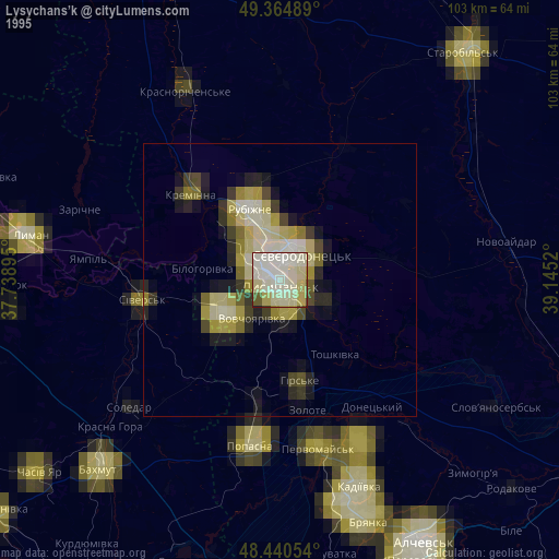
» NASA, Earths city lights 1995
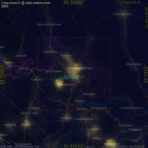
» NASA city lights 2003
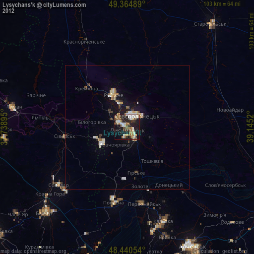
» Earth at Night: Flat Maps 2012, 2016