Lebedyn night lights from space
Night Light of Lebedyn (Sumy) from space (Ukraine) Src. Average luminocity for 10x10km area is 0.0227% and for 50x50km: 0.101%.
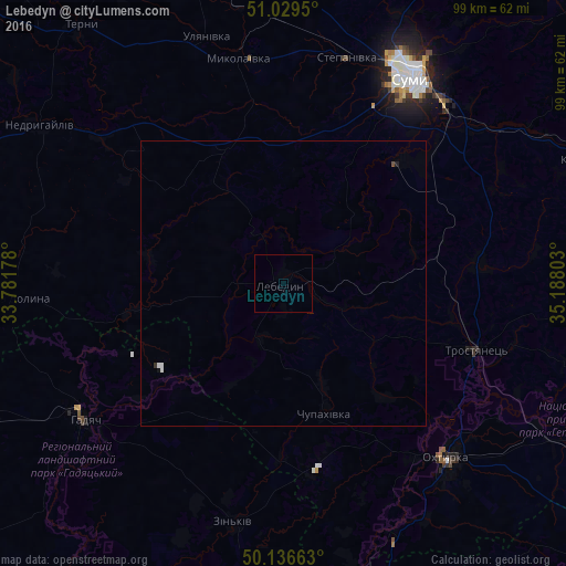
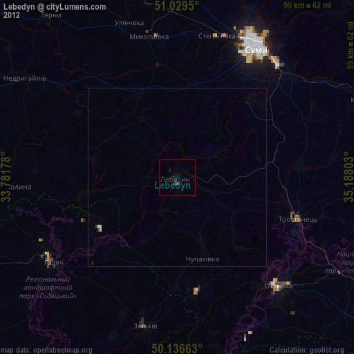
Analysis of Lebedyn night lights 2016
Square area 10x10 km:
 0%
0%90-99
0%80-89
0%70-79
0%60-69
0%50-59
0%40-49
0%30-39
0%20-29
0%10-19
0%0-9
100%Square area 50x50 km:
0.04%90-99
0.03%80-89
0%70-79
0%60-69
0%50-59
0.01%40-49
0.02%30-39
0.02%20-29
0.01%10-19
0.04%0-9
99.85%Clear (daylight) street map image can be seen on geolist.org.
Map coordinates:
51° 1' 46.2" North, 33° 46' 54.4" East
50° 35' 6.6" North, 34° 29' 5.6" East
50° 8' 11.9" North, 35° 11' 16.9" East
Some cities around Lebedyn sort by population:
• Sumy
43.5 km =27 mi,  30°
30°
• Okhtyrka
42.3 km =26.3 mi,  136°
136°
• Hadyach
42.3 km =26.3 mi,  235°
235°
• Zin’kiv
42.8 km =26.6 mi,  191°
191°
• Krasnopillya
58.5 km =36.4 mi,  68°
68°
• Trostyanets’
35.8 km =22.2 mi,  108°
108°
• Nedryhayliv
51 km =31.7 mi,  302°
302°
• Lypova Dolyna
48.6 km =30.2 mi,  267°
267°
613273 (p: 27,695)
Sources (retrieved 2019-11-25):
» Earth at Night: Flat Maps 2012, 2016