Dnipro night lights from space
Night Light of Dnipro (Dnipropetrovsk) from space (Ukraine) Src. Average luminocity for 10x10km area is 83.3608% and for 50x50km: 11.7818%.
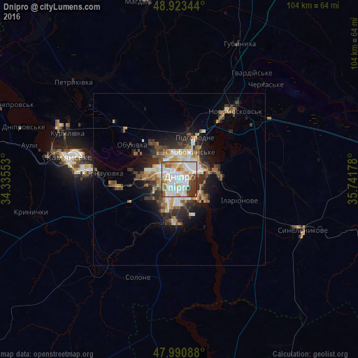
Analysis of Dnipro night lights 2016
Square area 10x10 km:
 32.1%
32.1%90-99
28.13%80-89
7.95%70-79
6.68%60-69
6.82%50-59
5.26%40-49
4.97%30-39
6.82%20-29
1.28%10-19
0%0-9
0%Square area 50x50 km:
2.15%90-99
2.25%80-89
1.11%70-79
1.46%60-69
1.33%50-59
1.59%40-49
1.89%30-39
2.18%20-29
3%10-19
4.9%0-9
78.13%Clear (daylight) street map image can be seen on geolist.org.
Map coordinates:
48° 55' 24.4" North, 34° 20' 7.9" East
48° 27' 33.5" North, 35° 2' 19.1" East
47° 59' 27.2" North, 35° 44' 30.4" East
Fantastic image of Dnipro from space taken by astronauts [src2], but I don't have information about it's orientation, scale or angle. If necessary, it was rotated manually, so North points approximately to upper direction. Click to zoom in:

Some cities around Dnipro sort by population:
• Kamianske
32.7 km =20.3 mi,  280°
280°
• Pavlohrad
61.9 km =38.5 mi,  82°
82°
• Novomoskovs’k
25 km =15.5 mi,  37°
37°
• Synel’nykove
38.6 km =24 mi,  113°
113°
• Pidhorodne
13.8 km =8.6 mi,  21°
21°
• Solone
30.5 km =19 mi,  203°
203°
• Mahdalynivka
52.1 km =32.4 mi,  349°
349°
• Hubynykha
42.1 km =26.2 mi, 22°
709930 (p: 1,032,822)
Sources (retrieved 2019-11-25):
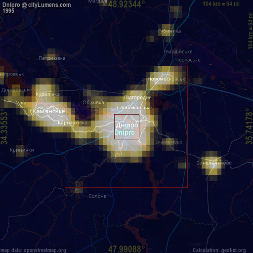
» NASA, Earths city lights 1995
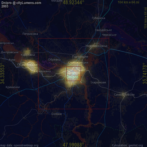
» NASA city lights 2003
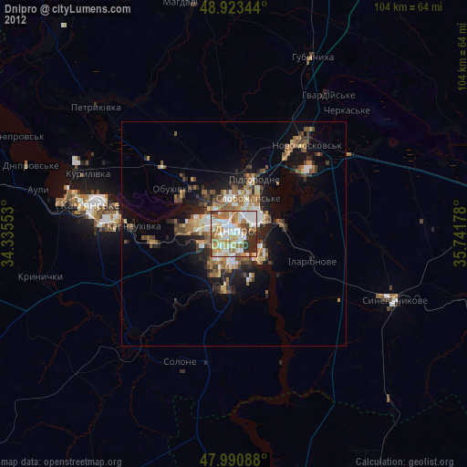
» Earth at Night: Flat Maps 2012, 2016
Src.2: picture by Oleg Kononenko, Roscosmos, retrieved 2019-11-29