Msanga night lights from space
Night Light of Msanga (Dodoma) from space (Tanzania) Src. Average luminocity for 10x10km area is 0.0537% and for 50x50km: 0.4825%.
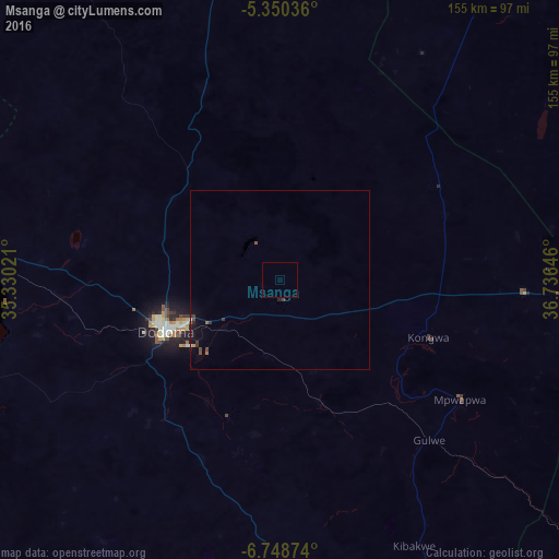
Analysis of Msanga night lights 2016
Square area 10x10 km:
100  0%
0%
90-99 0%
80-89 0%
70-79 0%
60-69 0%
50-59 0%
40-49 0%
30-39 0%
20-29 0%
10-19 0%
0-9 100%
0%90-99
0%80-89
0%70-79
0%60-69
0%50-59
0%40-49
0%30-39
0%20-29
0%10-19
0%0-9
100%Square area 50x50 km:
100 0.02%
90-99 0.02%
80-89 0.01%
70-79 0.03%
60-69 0.04%
50-59 0.09%
40-49 0.19%
30-39 0.15%
20-29 0.09%
10-19 0.51%
0-9 98.86%
0.02%90-99
0.02%80-89
0.01%70-79
0.03%60-69
0.04%50-59
0.09%40-49
0.19%30-39
0.15%20-29
0.09%10-19
0.51%0-9
98.86%Clear (daylight) street map image can be seen on geolist.org.
Map coordinates:
5° 21' 1.3" South, 35° 19' 48.8" East
6° 3' 0" South, 36° 1' 60" East
6° 44' 55.5" South, 36° 44' 11.3" East
Some cities around Msanga sort by population:
• Dodoma
35.2 km =21.9 mi,  247°
247°
• Geiro
92.8 km =57.7 mi,  96°
96°
• Mpwapwa
59.9 km =37.2 mi,  123°
123°
• Kibakwe
82.8 km =51.4 mi,  153°
153°
• Kongwa
45.5 km =28.3 mi,  111°
111°
• Kisasa
30 km =18.6 mi,  242°
242°
• Kintinku
90.4 km =56.2 mi,  281°
281°
• Kibaya
102.2 km =63.5 mi,  35°
35°
153046 (p: 5,527)
Sources (retrieved 2019-11-25):
» Earth at Night: Flat Maps 2012, 2016