Misungwi night lights from space
Night Light of Misungwi (Mwanza) from space (Tanzania) Src. Average luminocity for 10x10km area is 0.8355% and for 50x50km: 0.1719%.
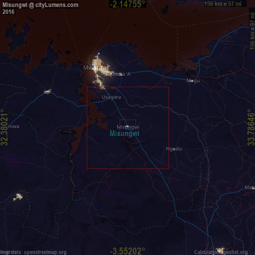
Analysis of Misungwi night lights 2016
Square area 10x10 km:
100  0%
0%
90-99 0%
80-89 0%
70-79 0.22%
60-69 0.65%
50-59 0%
40-49 0%
30-39 0%
20-29 0.87%
10-19 0%
0-9 98.27%
0%90-99
0%80-89
0%70-79
0.22%60-69
0.65%50-59
0%40-49
0%30-39
0%20-29
0.87%10-19
0%0-9
98.27%Square area 50x50 km:
100 0%
90-99 0%
80-89 0.02%
70-79 0.03%
60-69 0.03%
50-59 0%
40-49 0.07%
30-39 0.05%
20-29 0.07%
10-19 0.04%
0-9 99.7%
0%90-99
0%80-89
0.02%70-79
0.03%60-69
0.03%50-59
0%40-49
0.07%30-39
0.05%20-29
0.07%10-19
0.04%0-9
99.7%Clear (daylight) street map image can be seen on geolist.org.
Map coordinates:
2° 8' 51.2" South, 32° 22' 48.8" East
2° 51' 0" South, 33° 4' 60" East
3° 33' 7.3" South, 33° 47' 11.3" East
Some cities around Misungwi sort by population:
• Mwanza
42.3 km =26.3 mi,  331°
331°
• Ngudu
30.6 km =19 mi,  115°
115°
• Mhango
54.7 km =34 mi,  208°
208°
• Kihangara
41.9 km =26 mi,  44°
44°
• Usagara
20.7 km =12.9 mi, 333°
• Misasi
16.7 km =10.4 mi,  180°
180°
• Malya
50.4 km =31.3 mi,  107°
107°
• Nyanguge
35.8 km =22.2 mi,  21°
21°
153759 (p: 35,530)
Sources (retrieved 2019-11-25):
» Earth at Night: Flat Maps 2012, 2016