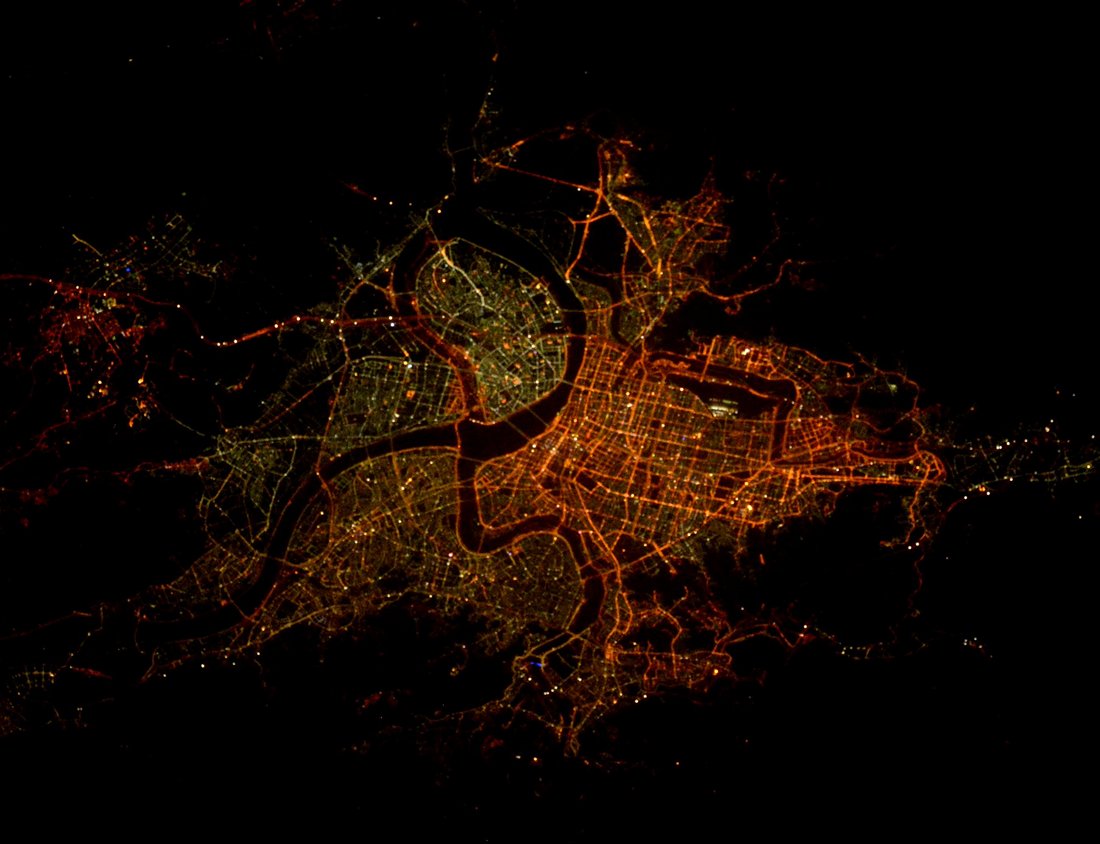
Taipei night lights from space
Night Light of Taipei (Taiwan) from space (Taiwan) Src. Average luminocity for 10x10km area is 99.1231% and for 50x50km: 46.914%.
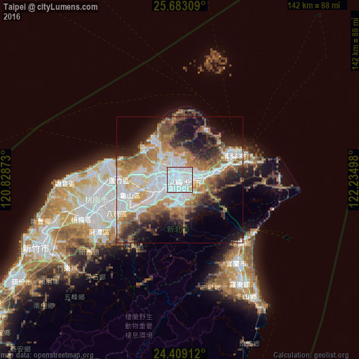

Analysis of Taipei night lights 2016
Square area 10x10 km:
 81.63%
90-99
15.15%80-89
1.89%70-79
1.33%60-69
0%50-59
0%40-49
0%30-39
0%20-29
0%10-19
0%0-9
0%Square area 50x50 km:
14.81%90-99
8.75%80-89
3.24%70-79
5.79%60-69
8.5%50-59
6.02%40-49
4.92%30-39
4.54%20-29
7.62%10-19
11.57%0-9
24.23%Clear (daylight) street map image can be seen on geolist.org.
Map coordinates:
25° 40' 59.1" North, 120° 49' 43.4" East
25° 2' 51.9" North, 121° 31' 54.7" East
24° 24' 32.8" North, 122° 14' 5.9" East
Fantastic image of Taipei from space taken by astronauts [src2], but I don't have information about it's orientation, scale or angle. If necessary, it was rotated manually, so North points approximately to upper direction. Click to zoom in:
Some cities around Taipei sort by population:
• Taichung
131.8 km =81.9 mi,  220°
220°
• Banqiao
7.5 km =4.7 mi,  240°
240°
• Hsinchu
62.9 km =39.1 mi, 244°
• Taoyuan City
24.4 km =15.2 mi,  255°
255°
• Keelung
23 km =14.3 mi,  67°
67°
• Hualien City
119.3 km =74.1 mi,  176°
176°
• Yilan
39.3 km =24.4 mi,  145°
145°
• Daxi
30.4 km =18.9 mi,  233°
233°
1668341 (p: 7,871,900)
Sources (retrieved 2019-11-25):
» NASA, Earths city lights 1995
» NASA city lights 2003
» Earth at Night: Flat Maps 2012, 2016
Src.2: Tim Kopra, Twitter/@astro_tim, 2016-05-08