Tainan night lights from space
Night Light of Tainan (Taiwan) from space (Taiwan) Src. Average luminocity for 10x10km area is 98.131% and for 50x50km: 50.0112%.
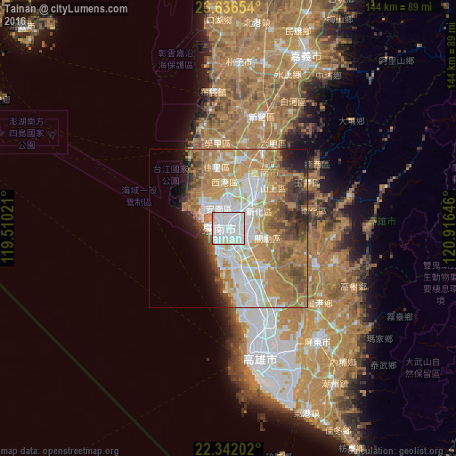
Analysis of Tainan night lights 2016
Square area 10x10 km:
 71.23%
90-99
21.83%80-89
4.17%70-79
2.78%60-69
0%50-59
0%40-49
0%30-39
0%20-29
0%10-19
0%0-9
0%Square area 50x50 km:
11.17%90-99
10.04%80-89
4.79%70-79
11.31%60-69
14.13%50-59
4.49%40-49
4.31%30-39
3.91%20-29
3.79%10-19
4.73%0-9
27.34%Clear (daylight) street map image can be seen on geolist.org.
Map coordinates:
23° 38' 11.5" North, 119° 30' 36.8" East
22° 59' 27" North, 120° 12' 48" East
22° 20' 31.3" North, 120° 54' 59.3" East
Some cities around Tainan sort by population:
• Kaohsiung
42.9 km =26.7 mi,  166°
166°
• Taitung City
98.8 km =61.4 mi,  105°
105°
• Nantou
112.6 km =70 mi,  24°
24°
• Douliu
86.7 km =53.9 mi, 22°
• Magong
90.5 km =56.2 mi,  314°
314°
• Donggang
63.3 km =39.3 mi,  157°
157°
• Lugu
100.4 km =62.4 mi,  33°
33°
• Yujing
29.4 km =18.3 mi,  59°
59°
1668355 (p: 771,235)
Sources (retrieved 2019-11-25):
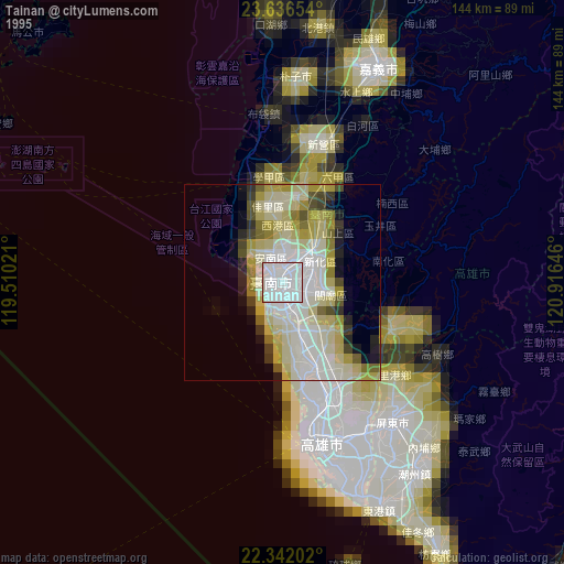
» NASA, Earths city lights 1995
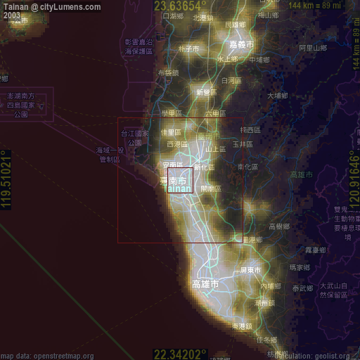
» NASA city lights 2003
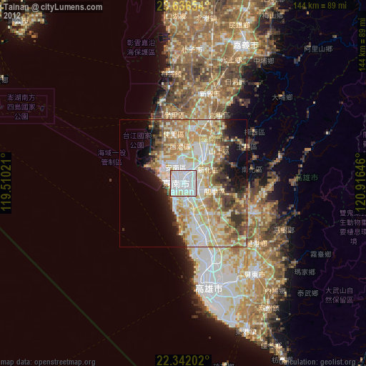
» Earth at Night: Flat Maps 2012, 2016