Taitung City night lights from space
Night Light of Taitung City (Taiwan) from space (Taiwan) Src. Average luminocity for 10x10km area is 49.3175% and for 50x50km: 5.3681%.
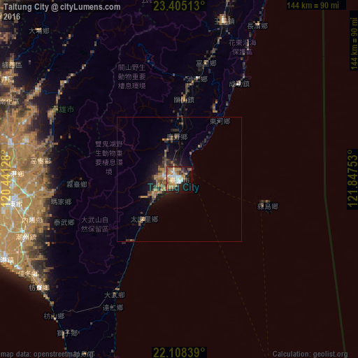
Analysis of Taitung City night lights 2016
Square area 10x10 km:
 7.34%
7.34%90-99
9.33%80-89
3.37%70-79
12.3%60-69
14.09%50-59
5.16%40-49
2.58%30-39
7.74%20-29
7.54%10-19
21.03%0-9
9.52%Square area 50x50 km:
0.33%90-99
0.43%80-89
0.2%70-79
1.01%60-69
1.68%50-59
0.7%40-49
0.69%30-39
1.54%20-29
1.34%10-19
4.05%0-9
88.03%Clear (daylight) street map image can be seen on geolist.org.
Map coordinates:
23° 24' 18.5" North, 120° 26' 28.6" East
22° 45' 29.9" North, 121° 8' 39.8" East
22° 6' 30.2" North, 121° 50' 51.1" East
Some cities around Taitung City sort by population:
• Kaohsiung
86.7 km =53.9 mi,  259°
259°
• Tainan
98.8 km =61.4 mi,  285°
285°
• Douliu
122.3 km =76 mi,  329°
329°
• Puli
135.5 km =84.2 mi,  352°
352°
• Donggang
78.4 km =48.7 mi,  245°
245°
• Hengchun
93.4 km =58 mi,  206°
206°
• Lugu
116.9 km =72.6 mi,  339°
339°
• Yujing
81 km =50.3 mi,  300°
300°
6949678 (p: 109,584)
Sources (retrieved 2019-11-25):
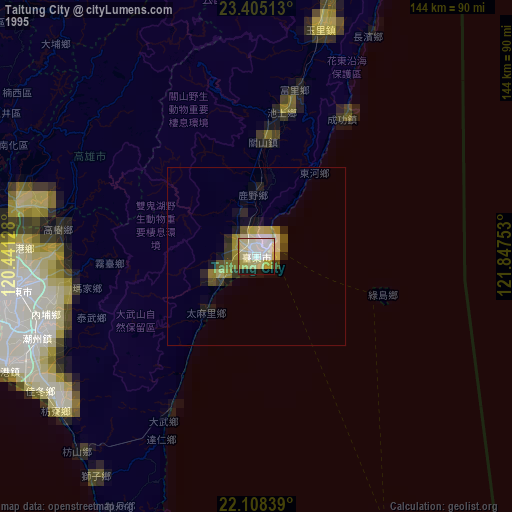
» NASA, Earths city lights 1995
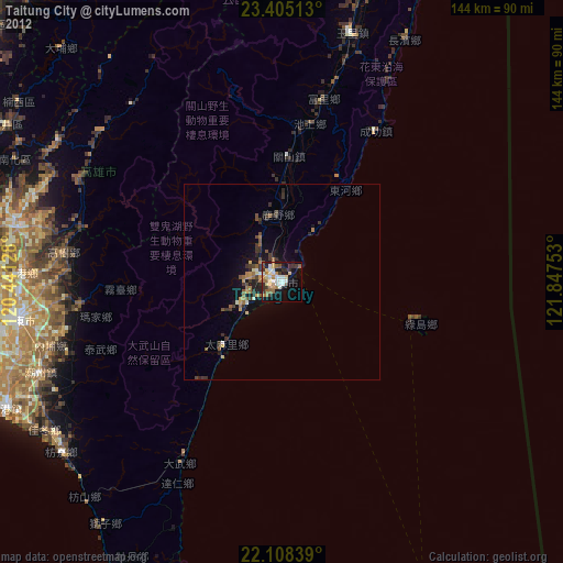
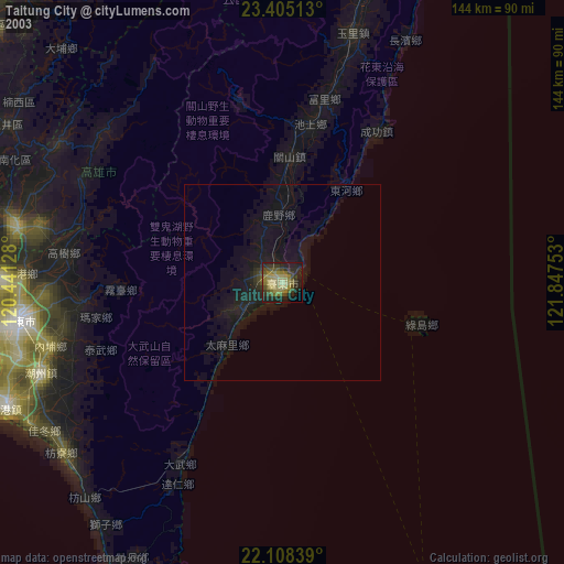
» NASA city lights 2003
» Earth at Night: Flat Maps 2012, 2016