Magong night lights from space
Night Light of Magong (Taiwan) from space (Taiwan) Src. Average luminocity for 10x10km area is 42.5278% and for 50x50km: 4.4031%.
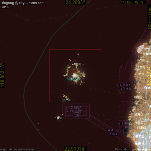
Analysis of Magong night lights 2016
Square area 10x10 km:
 5.16%
5.16%90-99
6.35%80-89
3.17%70-79
3.37%60-69
9.33%50-59
8.33%40-49
7.34%30-39
12.3%20-29
13.29%10-19
30.75%0-9
0.6%Square area 50x50 km:
0.23%90-99
0.26%80-89
0.26%70-79
0.42%60-69
1.09%50-59
0.96%40-49
0.89%30-39
1.17%20-29
1.2%10-19
4.17%0-9
89.33%Clear (daylight) street map image can be seen on geolist.org.
Map coordinates:
24° 12' 29.9" North, 118° 52' 59.3" East
23° 33' 55.4" North, 119° 35' 10.6" East
22° 55' 9.6" North, 120° 17' 21.8" East
Some cities around Magong sort by population:
• Taichung
129 km =80.2 mi,  59°
59°
• Tainan
90.5 km =56.2 mi,  134°
134°
• Yuanlin
109.7 km =68.2 mi,  66°
66°
• Nantou
116.4 km =72.3 mi, 70°
• Douliu
98.8 km =61.4 mi,  80°
80°
• Zhongxing New Village
120.1 km =74.6 mi, 68°
• Lugu
120.5 km =74.9 mi, 80°
• Yujing
101.9 km =63.3 mi,  118°
118°
1672228 (p: 56,435)
Sources (retrieved 2019-11-25):
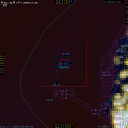
» NASA, Earths city lights 1995
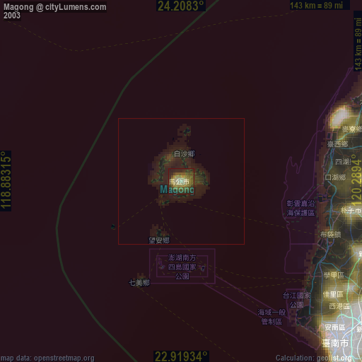
» NASA city lights 2003
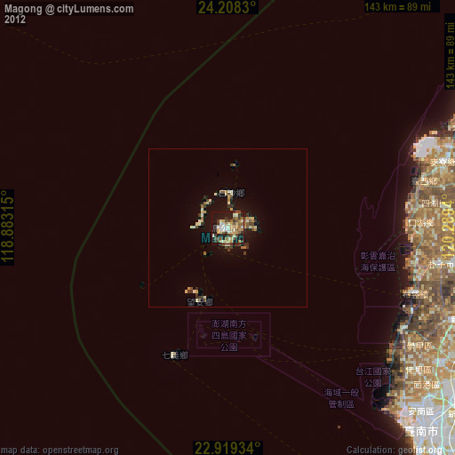
» Earth at Night: Flat Maps 2012, 2016