Ulubey night lights from space
Night Light of Ulubey (Uşak) from space (Turkey) Src. Average luminocity for 10x10km area is 7.1071% and for 50x50km: 5.1526%.
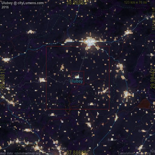
Analysis of Ulubey night lights 2016
Square area 10x10 km:
100  0%
0%
90-99 2.6%
80-89 1.3%
70-79 1.3%
60-69 0%
50-59 0.65%
40-49 0.16%
30-39 0.81%
20-29 0%
10-19 1.3%
0-9 91.88%
0%90-99
2.6%80-89
1.3%70-79
1.3%60-69
0%50-59
0.65%40-49
0.16%30-39
0.81%20-29
0%10-19
1.3%0-9
91.88%Square area 50x50 km:
100 0.03%
90-99 0.64%
80-89 0.56%
70-79 0.77%
60-69 0.75%
50-59 0.87%
40-49 0.62%
30-39 1.25%
20-29 1.56%
10-19 2.21%
0-9 90.71%
0.03%90-99
0.64%80-89
0.56%70-79
0.77%60-69
0.75%50-59
0.87%40-49
0.62%30-39
1.25%20-29
1.56%10-19
2.21%0-9
90.71%Clear (daylight) street map image can be seen on geolist.org.
Map coordinates:
38° 58' 7.1" North, 28° 35' 17.4" East
38° 25' 11.5" North, 29° 17' 28.6" East
37° 52' 0.8" North, 29° 59' 39.9" East
Some cities around Ulubey sort by population:
• Uşak
29.9 km =18.6 mi,  19°
19°
• Banaz
53.4 km =33.2 mi,  48°
48°
• Çivril
41.2 km =25.6 mi,  108°
108°
• Sarıgöl
55.6 km =34.5 mi,  248°
248°
• Eşme
28.2 km =17.5 mi,  265°
265°
• Selendi
51.6 km =32.1 mi,  314°
314°
• Sivaslı
35.3 km =21.9 mi,  75°
75°
• Baklan
56.5 km =35.1 mi,  150°
150°
298454 (p: 5,092)
Sources (retrieved 2019-11-25):
» Earth at Night: Flat Maps 2012, 2016