Tut night lights from space
Night Light of Tut (Adıyaman) from space (Turkey) Src. Average luminocity for 10x10km area is 3.0238% and for 50x50km: 3.0431%.
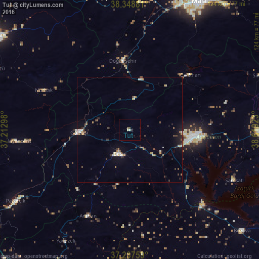
Analysis of Tut night lights 2016
Square area 10x10 km:
 0.17%
0.17%90-99
0.51%80-89
0.68%70-79
0%60-69
0%50-59
0.68%40-49
1.02%30-39
0.34%20-29
0.85%10-19
0.51%0-9
95.24%Square area 50x50 km:
0.18%90-99
0.58%80-89
0.19%70-79
0.45%60-69
0.28%50-59
0.26%40-49
0.66%30-39
0.51%20-29
0.63%10-19
1.36%0-9
94.89%Clear (daylight) street map image can be seen on geolist.org.
Map coordinates:
38° 20' 55.7" North, 37° 12' 46.7" East
37° 47' 43" North, 37° 54' 58" East
37° 14' 15.3" North, 38° 37' 9.2" East
Some cities around Tut sort by population:
• Adıyaman
31.8 km =19.8 mi,  96°
96°
• Besni
12.4 km =7.7 mi,  202°
202°
• Gölbaşı
24.6 km =15.3 mi,  266°
266°
• Doğanşehir
32.5 km =20.2 mi,  353°
353°
• Çelikhan
38 km =23.6 mi,  47°
47°
• Araban
45.6 km =28.3 mi,  206°
206°
• Samsat
54.5 km =33.9 mi,  115°
115°
• Nurhak
45.7 km =28.4 mi,  294°
294°
298728 (p: 7,560)
Sources (retrieved 2019-11-25):
» Earth at Night: Flat Maps 2012, 2016