Şanlıurfa night lights from space
Night Light of Şanlıurfa from space (Turkey) Src. Average luminocity for 10x10km area is 78.1207% and for 50x50km: 13.1464%.
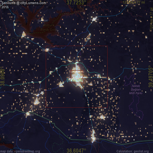
Analysis of Şanlıurfa night lights 2016
Square area 10x10 km:
 21.26%
90-99
26.87%80-89
13.1%70-79
7.14%60-69
6.29%50-59
8.84%40-49
5.44%30-39
4.42%20-29
6.46%10-19
0.17%0-9
0%Square area 50x50 km:
1.67%90-99
2.42%80-89
1.34%70-79
0.96%60-69
0.91%50-59
2.12%40-49
2.6%30-39
2.12%20-29
3.71%10-19
7.72%0-9
74.42%Clear (daylight) street map image can be seen on geolist.org.
Map coordinates:
37° 43' 31.1" North, 38° 5' 26.9" East
37° 10' 1.5" North, 38° 47' 38.1" East
36° 36' 16.9" North, 39° 29' 49.4" East
Some cities around Şanlıurfa sort by population:
• Kâhta
70.4 km =43.7 mi,  347°
347°
• ‘Ayn al ‘Arab, SY
49.7 km =30.9 mi,  231°
231°
• Suruç
39 km =24.2 mi,  237°
237°
• Akçakale
52.5 km =32.6 mi,  164°
164°
• Bozova
32.1 km =19.9 mi,  312°
312°
• Hilvan
48.8 km =30.3 mi,  16°
16°
• Harran
40.1 km =24.9 mi,  148°
148°
• Samsat
54.1 km =33.6 mi,  328°
328°
298333 (p: 449,549)
Sources (retrieved 2019-11-25):
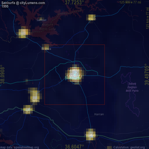
» NASA, Earths city lights 1995
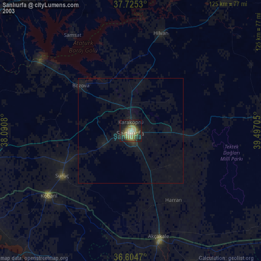
» NASA city lights 2003
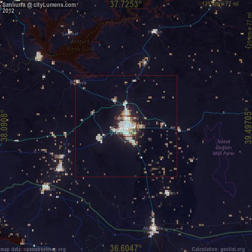
» Earth at Night: Flat Maps 2012, 2016