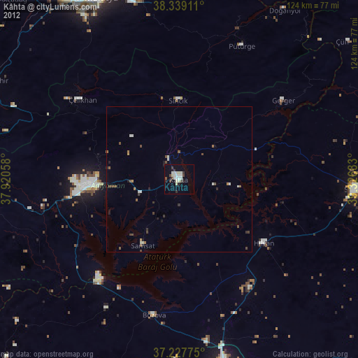
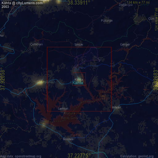
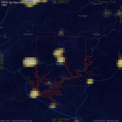
Kâhta night lights from space
Night Light of Kâhta (Adıyaman) from space (Turkey) Src. Average luminocity for 10x10km area is 22.5017% and for 50x50km: 2.887%.
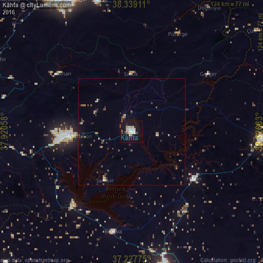
Analysis of Kâhta night lights 2016
Square area 10x10 km:
 2.55%
2.55%90-99
5.61%80-89
4.42%70-79
2.38%60-69
1.87%50-59
1.19%40-49
0.68%30-39
0.85%20-29
2.04%10-19
27.55%0-9
50.85%Square area 50x50 km:
0.16%90-99
0.36%80-89
0.36%70-79
0.26%60-69
0.38%50-59
0.53%40-49
0.59%30-39
0.63%20-29
0.45%10-19
1.77%0-9
94.52%Clear (daylight) street map image can be seen on geolist.org.
Map coordinates:
38° 20' 20.8" North, 37° 55' 14.1" East
37° 47' 7.9" North, 38° 37' 25.3" East
37° 13' 39.9" North, 39° 19' 36.6" East
Some cities around Kâhta sort by population:
• Adıyaman
30.6 km =19 mi,  265°
265°
• Siverek
61 km =37.9 mi,  93°
93°
• Bozova
47.8 km =29.7 mi,  190°
190°
• Hilvan
36.6 km =22.7 mi,  127°
127°
• Çelikhan
43.2 km =26.8 mi,  308°
308°
• Samsat
26.2 km =16.3 mi,  210°
210°
• Tut
62.2 km =38.6 mi, 271°
• Sincik
27.9 km =17.3 mi,  357°
357°
310855 (p: 73,105)
Sources (retrieved 2019-11-25):
» NASA, Earths city lights 1995
» NASA city lights 2003
» Earth at Night: Flat Maps 2012, 2016