Köse night lights from space
Night Light of Köse (Gümüşhane) from space (Turkey) Src. Average luminocity for 10x10km area is 2.9675% and for 50x50km: 1.7131%.
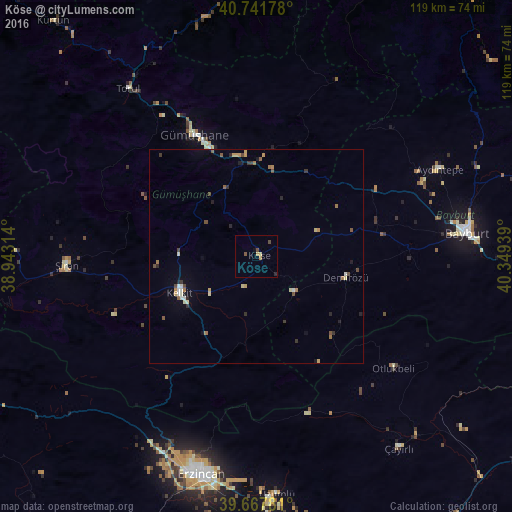
Analysis of Köse night lights 2016
Square area 10x10 km:
 0%
0%90-99
0%80-89
0.49%70-79
0.81%60-69
0.65%50-59
0.65%40-49
1.3%30-39
0%20-29
0.65%10-19
0%0-9
95.45%Square area 50x50 km:
0.09%90-99
0.23%80-89
0.18%70-79
0.3%60-69
0.31%50-59
0.25%40-49
0.34%30-39
0.25%20-29
0.3%10-19
0.25%0-9
97.5%Clear (daylight) street map image can be seen on geolist.org.
Map coordinates:
40° 44' 30.4" North, 38° 56' 35.3" East
40° 12' 24.9" North, 39° 38' 46.5" East
39° 40' 4.1" North, 40° 20' 57.8" East
Some cities around Köse sort by population:
• Erzincan
53.7 km =33.4 mi,  194°
194°
• Cimin
55.5 km =34.5 mi,  175°
175°
• Gumushkhane
31.8 km =19.8 mi,  332°
332°
• Bayburt
49.3 km =30.6 mi,  83°
83°
• Kelkit
20.1 km =12.5 mi,  243°
243°
• Şiran
44.9 km =27.9 mi,  267°
267°
• Maçka
67.2 km =41.8 mi,  357°
357°
• Aydıntepe
46.4 km =28.8 mi,  65°
65°
742606 (p: 8,705)
Sources (retrieved 2019-11-25):
» Earth at Night: Flat Maps 2012, 2016