Bayburt night lights from space
Night Light of Bayburt from space (Turkey) Src. Average luminocity for 10x10km area is 28.7987% and for 50x50km: 2.1508%.
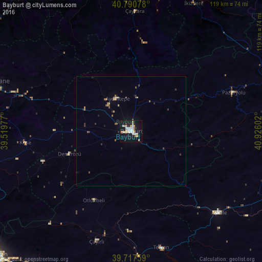
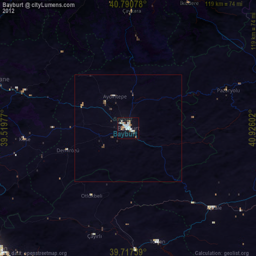
Analysis of Bayburt night lights 2016
Square area 10x10 km:
 6.33%
6.33%90-99
4.87%80-89
5.52%70-79
4.22%60-69
1.62%50-59
1.14%40-49
0%30-39
0.32%20-29
2.76%10-19
38.8%0-9
34.42%Square area 50x50 km:
0.27%90-99
0.23%80-89
0.33%70-79
0.28%60-69
0.2%50-59
0.31%40-49
0.17%30-39
0.23%20-29
0.32%10-19
1.89%0-9
95.77%Clear (daylight) street map image can be seen on geolist.org.
Map coordinates:
40° 47' 26.8" North, 39° 31' 11.2" East
40° 15' 22.7" North, 40° 13' 22.4" East
39° 43' 3.3" North, 40° 55' 33.7" East
Some cities around Bayburt sort by population:
• Aşkale
54.8 km =34.1 mi,  132°
132°
• Çaykara
54.1 km =33.6 mi,  0°
0°
• Tercan
54.9 km =34.1 mi,  166°
166°
• Köse
49.3 km =30.6 mi,  263°
263°
• Aydıntepe
15.7 km =9.8 mi,  334°
334°
• Dernekpazarı
60.1 km =37.3 mi, 1°
• Pazaryolu
49.3 km =30.6 mi,  69°
69°
• Köprübaşı
61.9 km =38.5 mi,  351°
351°
750938 (p: 31,258)
Sources (retrieved 2019-11-25):
» Earth at Night: Flat Maps 2012, 2016