Şiran night lights from space
Night Light of Şiran (Gümüşhane) from space (Turkey) Src. Average luminocity for 10x10km area is 8.3588% and for 50x50km: 0.7424%.
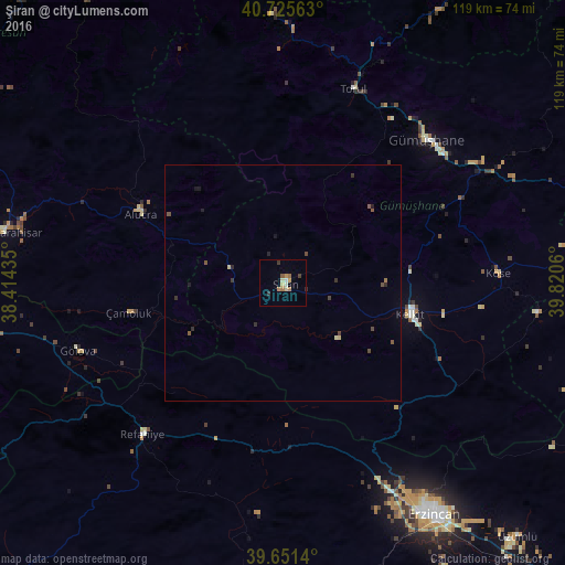
Analysis of Şiran night lights 2016
Square area 10x10 km:
 0.16%
0.16%90-99
1.3%80-89
1.79%70-79
1.3%60-69
2.6%50-59
0.49%40-49
0.32%30-39
1.79%20-29
0.32%10-19
0%0-9
89.94%Square area 50x50 km:
0.01%90-99
0.06%80-89
0.14%70-79
0.05%60-69
0.13%50-59
0.14%40-49
0.17%30-39
0.22%20-29
0.18%10-19
0.12%0-9
98.77%Clear (daylight) street map image can be seen on geolist.org.
Map coordinates:
40° 43' 32.3" North, 38° 24' 51.7" East
40° 11' 26.3" North, 39° 7' 2.9" East
39° 39' 5" North, 39° 49' 14.2" East
Some cities around Şiran sort by population:
• Erzincan
59.4 km =36.9 mi,  147°
147°
• Şebin Karahisar
59.9 km =37.2 mi,  280°
280°
• Cimin
73 km =45.4 mi,  137°
137°
• Gumushkhane
42.4 km =26.3 mi,  45°
45°
• Kelkit
27.8 km =17.3 mi,  104°
104°
• Tonya
78.4 km =48.7 mi,  10°
10°
• Köse
44.9 km =27.9 mi,  87°
87°
• Refahiye
44.6 km =27.7 mi,  222°
222°
739574 (p: 14,692)
Sources (retrieved 2019-11-25):
» Earth at Night: Flat Maps 2012, 2016