Reyhanlı night lights from space
Night Light of Reyhanlı (Hatay) from space (Turkey) Src. Average luminocity for 10x10km area is 38.6643% and for 50x50km: 6.1363%.
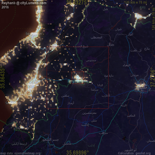
Analysis of Reyhanlı night lights 2016
Square area 10x10 km:
 6.12%
6.12%90-99
9.09%80-89
5.59%70-79
4.37%60-69
1.75%50-59
3.67%40-49
4.72%30-39
5.59%20-29
8.92%10-19
41.61%0-9
8.57%Square area 50x50 km:
0.33%90-99
0.89%80-89
0.86%70-79
0.57%60-69
0.41%50-59
0.8%40-49
1.06%30-39
1.2%20-29
1.46%10-19
6.89%0-9
85.52%Clear (daylight) street map image can be seen on geolist.org.
Map coordinates:
36° 49' 57.9" North, 35° 51' 51.7" East
36° 16' 4.5" North, 36° 34' 2.9" East
35° 41' 56.3" North, 37° 16' 14.2" East
Some cities around Reyhanlı sort by population:
• Kırıkhan
31.9 km =19.8 mi,  323°
323°
• Ma‘arratmişrīn, SY
30 km =18.6 mi,  161°
161°
• Salqīn, SY
17.7 km =11 mi,  215°
215°
• Binnish, SY
37 km =23 mi, 159°
• Kafr Takhārīm, SY
17.4 km =10.8 mi,  195°
195°
• Ad Dānā, SY
19.2 km =11.9 mi,  108°
108°
• Serinyol
33.4 km =20.8 mi,  288°
288°
• Kastal
29.4 km =18.3 mi,  265°
265°
302355 (p: 56,995)
Sources (retrieved 2019-11-25):
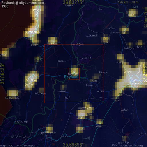
» NASA, Earths city lights 1995
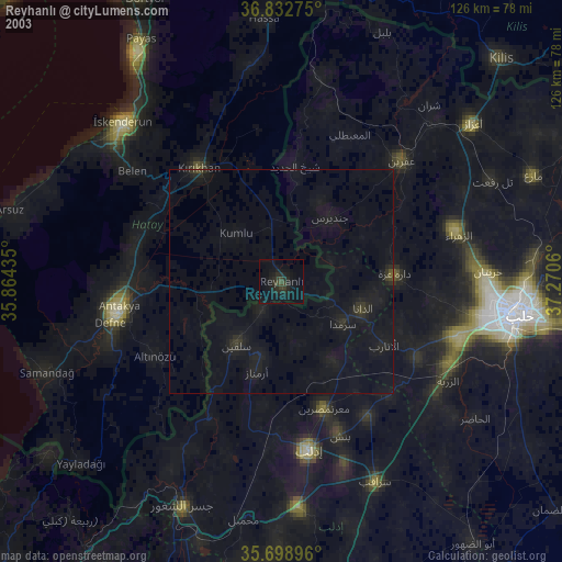
» NASA city lights 2003
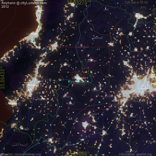
» Earth at Night: Flat Maps 2012, 2016