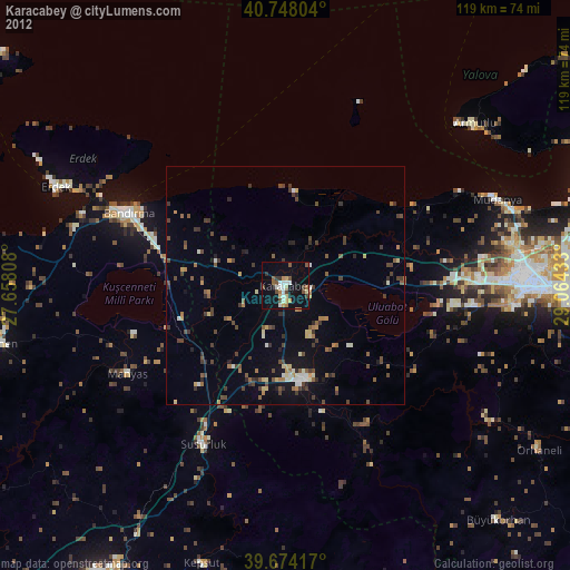
Karacabey night lights from space
Night Light of Karacabey (Bursa) from space (Turkey) Src. Average luminocity for 10x10km area is 25.9935% and for 50x50km: 6.2582%.
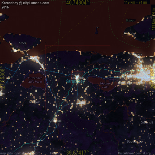
Analysis of Karacabey night lights 2016
Square area 10x10 km:
 3.41%
3.41%90-99
5.36%80-89
2.76%70-79
1.46%60-69
3.73%50-59
3.08%40-49
2.11%30-39
3.57%20-29
4.55%10-19
36.85%0-9
33.12%Square area 50x50 km:
0.3%90-99
0.72%80-89
0.65%70-79
0.47%60-69
1.2%50-59
1.12%40-49
1.06%30-39
0.97%20-29
1.58%10-19
4.77%0-9
87.17%Clear (daylight) street map image can be seen on geolist.org.
Map coordinates:
40° 44' 52.9" North, 27° 39' 29.1" East
40° 12' 47.6" North, 28° 21' 40.3" East
39° 40' 27" North, 29° 3' 51.6" East
Some cities around Karacabey sort by population:
• Bursa
59.4 km =36.9 mi,  91°
91°
• Bandırma
36.1 km =22.4 mi,  295°
295°
• Mustafakemalpaşa
19.9 km =12.4 mi,  168°
168°
• Susurluk
37.5 km =23.3 mi,  207°
207°
• Mudanya
47.7 km =29.6 mi,  67°
67°
• Erdek
52.4 km =32.6 mi,  293°
293°
• Kepsut
61 km =37.9 mi,  196°
196°
• Manyas
38.1 km =23.7 mi,  240°
240°
744537 (p: 44,256)
Sources (retrieved 2019-11-25):
» Earth at Night: Flat Maps 2012, 2016