Bursa night lights from space
Night Light of Bursa from space (Turkey) Src. Average luminocity for 10x10km area is 76.4594% and for 50x50km: 23.3459%.
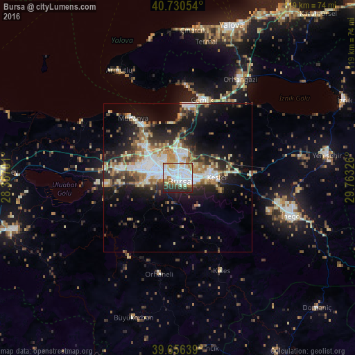
Analysis of Bursa night lights 2016
Square area 10x10 km:
 28.08%
90-99
26.3%80-89
2.92%70-79
8.6%60-69
8.77%50-59
1.3%40-49
4.55%30-39
6.17%20-29
13.15%10-19
0.16%0-9
0%Square area 50x50 km:
4.18%90-99
5.28%80-89
2.16%70-79
2.47%60-69
3.55%50-59
2.52%40-49
2.65%30-39
3.83%20-29
6.72%10-19
11.53%0-9
55.12%Clear (daylight) street map image can be seen on geolist.org.
Map coordinates:
40° 43' 49.9" North, 28° 21' 25.2" East
40° 11' 44.1" North, 29° 3' 36.5" East
39° 39' 23" North, 29° 45' 47.7" East
Some cities around Bursa sort by population:
• İnegol
40.7 km =25.3 mi,  108°
108°
• Gemlik
27.5 km =17.1 mi,  17°
17°
• Orhangazi
38.9 km =24.2 mi,  32°
32°
• Kestel
12.9 km =8 mi,  88°
88°
• Gürsu
11.7 km =7.3 mi,  77°
77°
• Mudanya
25 km =15.5 mi,  322°
322°
• Orhaneli
33 km =20.5 mi,  190°
190°
• Demirtaş
9.1 km =5.7 mi, 20°
750269 (p: 1,412,701)
Sources (retrieved 2019-11-25):
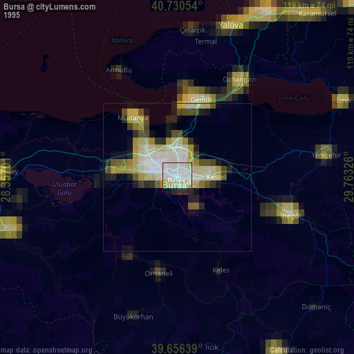
» NASA, Earths city lights 1995
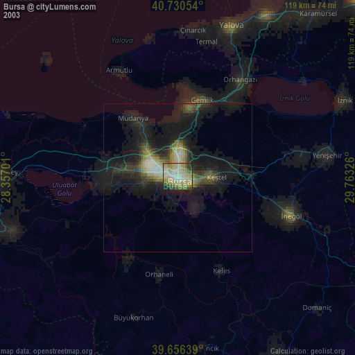
» NASA city lights 2003
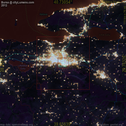
» Earth at Night: Flat Maps 2012, 2016