Gördes night lights from space
Night Light of Gördes (Manisa) from space (Turkey) Src. Average luminocity for 10x10km area is 7.7789% and for 50x50km: 2.0648%.
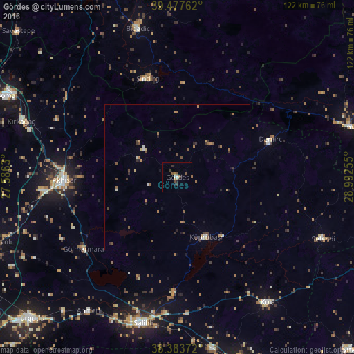
Analysis of Gördes night lights 2016
Square area 10x10 km:
 0.85%
0.85%90-99
1.02%80-89
0.17%70-79
0.85%60-69
1.19%50-59
1.7%40-49
2.04%30-39
1.36%20-29
1.53%10-19
1.19%0-9
88.1%Square area 50x50 km:
0.05%90-99
0.29%80-89
0.14%70-79
0.3%60-69
0.31%50-59
0.47%40-49
0.47%30-39
0.55%20-29
0.45%10-19
0.4%0-9
96.58%Clear (daylight) street map image can be seen on geolist.org.
Map coordinates:
39° 28' 39.4" North, 27° 35' 10.7" East
38° 55' 58" North, 28° 17' 21.9" East
38° 23' 1.4" North, 28° 59' 33.2" East
Some cities around Gördes sort by population:
• Salihli
51.5 km =32 mi,  193°
193°
• Akhisar
38.9 km =24.2 mi,  267°
267°
• Kula
53 km =32.9 mi,  143°
143°
• Demirci
34.3 km =21.3 mi,  68°
68°
• Bigadiç
52.9 km =32.9 mi,  345°
345°
• Gölmarmara
40.6 km =25.2 mi,  233°
233°
• Sındırgı
35.6 km =22.1 mi,  344°
344°
• Selendi
54.3 km =33.7 mi,  112°
112°
313960 (p: 11,168)
Sources (retrieved 2019-11-25):
» Earth at Night: Flat Maps 2012, 2016