Edremit night lights from space
Night Light of Edremit (Van) from space (Turkey) Src. Average luminocity for 10x10km area is 31.638% and for 50x50km: 9.9864%.
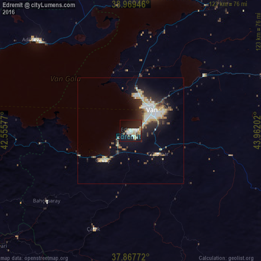
Analysis of Edremit night lights 2016
Square area 10x10 km:
100  2.76%
2.76%
90-99 9.58%
80-89 5.36%
70-79 2.6%
60-69 3.08%
50-59 0.65%
40-49 1.95%
30-39 1.79%
20-29 12.82%
10-19 37.99%
0-9 21.43%
2.76%90-99
9.58%80-89
5.36%70-79
2.6%60-69
3.08%50-59
0.65%40-49
1.95%30-39
1.79%20-29
12.82%10-19
37.99%0-9
21.43%Square area 50x50 km:
100 1.26%
90-99 2.25%
80-89 1.42%
70-79 1.17%
60-69 0.8%
50-59 0.75%
40-49 1.21%
30-39 1.39%
20-29 3.03%
10-19 6.41%
0-9 80.32%
1.26%90-99
2.25%80-89
1.42%70-79
1.17%60-69
0.8%50-59
0.75%40-49
1.21%30-39
1.39%20-29
3.03%10-19
6.41%0-9
80.32%Clear (daylight) street map image can be seen on geolist.org.
Map coordinates:
38° 58' 10.1" North, 42° 33' 20.8" East
38° 25' 14.5" North, 43° 15' 32" East
37° 52' 3.8" North, 43° 57' 43.3" East
Some cities around Edremit sort by population:
• Van
13.6 km =8.5 mi,  52°
52°
• Erciş
67.9 km =42.2 mi,  7°
7°
• Ahlat
76.9 km =47.8 mi,  298°
298°
• Adilcevaz
62.2 km =38.6 mi,  312°
312°
• Hizan
76.5 km =47.5 mi,  253°
253°
• Başkale
78.3 km =48.7 mi,  122°
122°
• Gevaş
19.8 km =12.3 mi,  223°
223°
• Özalp
68.6 km =42.6 mi,  67°
67°
301529 (p: 7,464)
Sources (retrieved 2019-11-25):
» Earth at Night: Flat Maps 2012, 2016