Erciş night lights from space
Night Light of Erciş (Van) from space (Turkey) Src. Average luminocity for 10x10km area is 46.7971% and for 50x50km: 3.284%.
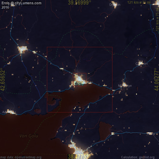
Analysis of Erciş night lights 2016
Square area 10x10 km:
 6.49%
6.49%90-99
9.42%80-89
4.55%70-79
13.8%60-69
2.6%50-59
4.38%40-49
7.79%30-39
5.36%20-29
15.58%10-19
27.44%0-9
2.6%Square area 50x50 km:
0.28%90-99
0.4%80-89
0.3%70-79
0.83%60-69
0.26%50-59
0.3%40-49
0.67%30-39
0.5%20-29
0.91%10-19
2.83%0-9
92.72%Clear (daylight) street map image can be seen on geolist.org.
Map coordinates:
39° 34' 12" North, 42° 39' 23.5" East
39° 1' 33.1" North, 43° 21' 34.7" East
38° 28' 39.1" North, 44° 3' 46" East
Some cities around Erciş sort by population:
• Van
59.1 km =36.7 mi,  178°
178°
• Patnos
48.7 km =30.3 mi,  297°
297°
• Adilcevaz
59.9 km =37.2 mi,  245°
245°
• Malazgirt
72.4 km =45 mi,  280°
280°
• Diyadin
63.2 km =39.3 mi,  25°
25°
• Özalp
68.4 km =42.5 mi,  127°
127°
• Edremit
67.9 km =42.2 mi,  187°
187°
• Taşlıçay
67.1 km =41.7 mi,  0°
0°
315530 (p: 91,915)
Sources (retrieved 2019-11-25):
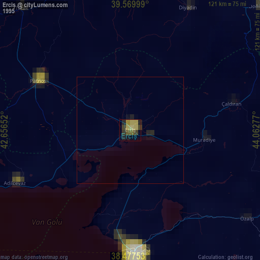
» NASA, Earths city lights 1995
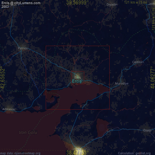
» NASA city lights 2003
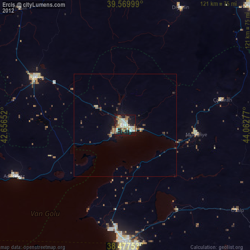
» Earth at Night: Flat Maps 2012, 2016