Eceabat night lights from space
Night Light of Eceabat (Canakkale) from space (Turkey) Src. Average luminocity for 10x10km area is 15.3799% and for 50x50km: 4.3459%.
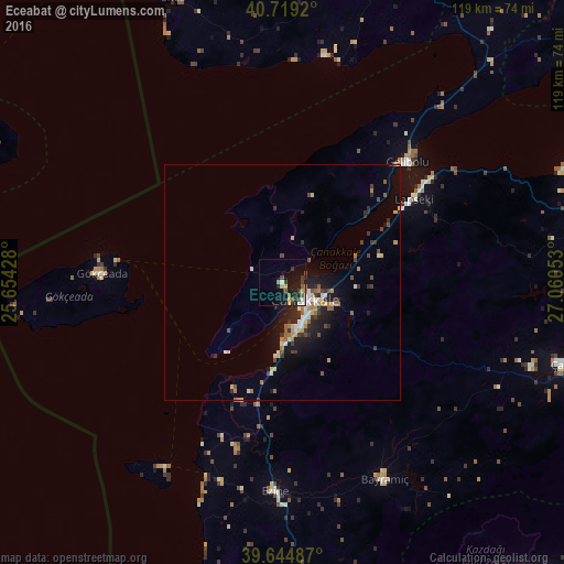
Analysis of Eceabat night lights 2016
Square area 10x10 km:
 1.62%
1.62%90-99
1.95%80-89
0.65%70-79
2.11%60-69
3.25%50-59
1.79%40-49
2.92%30-39
2.27%20-29
3.9%10-19
15.1%0-9
64.45%Square area 50x50 km:
0.28%90-99
0.69%80-89
0.46%70-79
0.43%60-69
0.89%50-59
0.47%40-49
0.65%30-39
0.71%20-29
1.26%10-19
3.16%0-9
91.01%Clear (daylight) street map image can be seen on geolist.org.
Map coordinates:
40° 43' 9.1" North, 25° 39' 15.4" East
40° 11' 3" North, 26° 21' 26.6" East
39° 38' 41.5" North, 27° 3' 37.9" East
Some cities around Eceabat sort by population:
• Çanakkale
5.7 km =3.5 mi,  124°
124°
• Çan
61.4 km =38.2 mi,  105°
105°
• Gelibolu
36.6 km =22.7 mi,  46°
46°
• Ezine
44.3 km =27.5 mi,  181°
181°
• Altınoluk
74.6 km =46.4 mi,  154°
154°
• Lapseki
33 km =20.5 mi,  57°
57°
• Gökçeada
38.1 km =23.7 mi,  272°
272°
• Ayvacık
65 km =40.4 mi, 176°
747728 (p: 5,120)
Sources (retrieved 2019-11-25):
» Earth at Night: Flat Maps 2012, 2016