Lapseki night lights from space
Night Light of Lapseki (Canakkale) from space (Turkey) Src. Average luminocity for 10x10km area is 19.3912% and for 50x50km: 3.6707%.
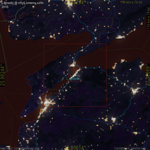
Analysis of Lapseki night lights 2016
Square area 10x10 km:
 1.19%
1.19%90-99
5.27%80-89
3.91%70-79
1.19%60-69
1.36%50-59
0.68%40-49
0.68%30-39
1.7%20-29
5.27%10-19
20.24%0-9
58.5%Square area 50x50 km:
0.31%90-99
0.65%80-89
0.32%70-79
0.2%60-69
0.81%50-59
0.53%40-49
0.52%30-39
0.59%20-29
1%10-19
2.38%0-9
92.69%Clear (daylight) street map image can be seen on geolist.org.
Map coordinates:
40° 52' 40.6" North, 25° 58' 56.8" East
40° 20' 39" North, 26° 41' 8" East
39° 48' 22.1" North, 27° 23' 19.3" East
Some cities around Lapseki sort by population:
• Çanakkale
31.2 km =19.4 mi,  227°
227°
• Keşan
57.1 km =35.5 mi,  355°
355°
• Biga
48.9 km =30.4 mi,  105°
105°
• Malkara
63.4 km =39.4 mi,  16°
16°
• Çan
46.5 km =28.9 mi,  137°
137°
• Gelibolu
7.5 km =4.7 mi,  350°
350°
• Gökçeada
67.8 km =42.1 mi,  256°
256°
• Eceabat
33 km =20.5 mi,  237°
237°
741878 (p: 10,076)
Sources (retrieved 2019-11-25):
» Earth at Night: Flat Maps 2012, 2016