Dicle night lights from space
Night Light of Dicle (Diyarbakır) from space (Turkey) Src. Average luminocity for 10x10km area is 11.0952% and for 50x50km: 2.7195%.
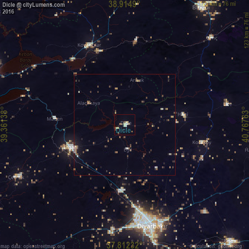
Analysis of Dicle night lights 2016
Square area 10x10 km:
 0.51%
0.51%90-99
2.21%80-89
2.55%70-79
0.17%60-69
1.02%50-59
1.7%40-49
3.57%30-39
0.17%20-29
0.68%10-19
1.87%0-9
85.54%Square area 50x50 km:
0.11%90-99
0.35%80-89
0.25%70-79
0.24%60-69
0.26%50-59
0.62%40-49
0.8%30-39
0.48%20-29
0.78%10-19
1.14%0-9
94.97%Clear (daylight) street map image can be seen on geolist.org.
Map coordinates:
38° 54' 53.6" North, 39° 21' 41" East
38° 21' 56.6" North, 40° 3' 52.2" East
37° 48' 44.4" North, 40° 46' 3.5" East
Some cities around Dicle sort by population:
• Diyarbakır
52 km =32.3 mi,  165°
165°
• Ergani
29.1 km =18.1 mi,  248°
248°
• Kovancılar
43 km =26.7 mi,  335°
335°
• Lice
51.1 km =31.8 mi,  78°
78°
• Palu
38.3 km =23.8 mi, 340°
• Hani
28.4 km =17.6 mi, 80°
• Kocaköy
38.8 km =24.1 mi,  102°
102°
• Arıcak
22.6 km =14 mi,  13°
13°
316746 (p: 13,017)
Sources (retrieved 2019-11-25):
» Earth at Night: Flat Maps 2012, 2016