Diyarbakır night lights from space
Night Light of Diyarbakır from space (Turkey) Src. Average luminocity for 10x10km area is 82.0487% and for 50x50km: 14.4813%.
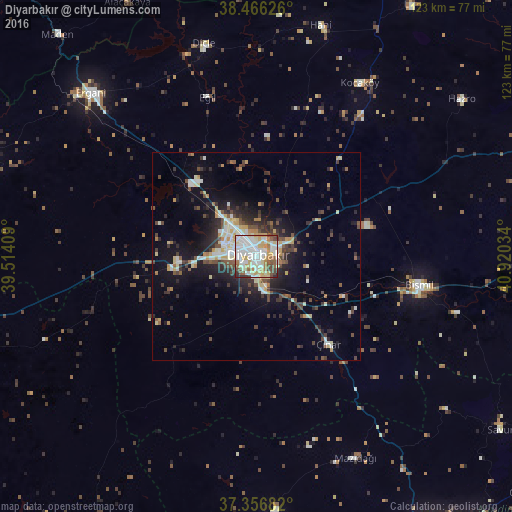
Analysis of Diyarbakır night lights 2016
Square area 10x10 km:
 24.51%
90-99
27.6%80-89
14.29%70-79
8.6%60-69
5.03%50-59
8.6%40-49
6.82%30-39
2.11%20-29
2.44%10-19
0%0-9
0%Square area 50x50 km:
1.91%90-99
2.99%80-89
1.93%70-79
1.37%60-69
0.86%50-59
1.39%40-49
3.04%30-39
2.44%20-29
4.19%10-19
7.95%0-9
71.94%Clear (daylight) street map image can be seen on geolist.org.
Map coordinates:
38° 27' 58.5" North, 39° 30' 50.7" East
37° 54' 49.1" North, 40° 13' 2" East
37° 21' 24.6" North, 40° 55' 13.2" East
Some cities around Diyarbakır sort by population:
• Bismil
39.5 km =24.5 mi,  101°
101°
• Ergani
56.6 km =35.2 mi,  314°
314°
• Mazıdağı
53.7 km =33.4 mi,  154°
154°
• Dicle
52 km =32.3 mi,  345°
345°
• Hani
56.8 km =35.3 mi,  15°
15°
• Salat
59.3 km =36.8 mi, 97°
• Kocaköy
48.4 km =30.1 mi,  30°
30°
• Ambar
28.1 km =17.5 mi, 103°
316541 (p: 644,763)
Sources (retrieved 2019-11-25):
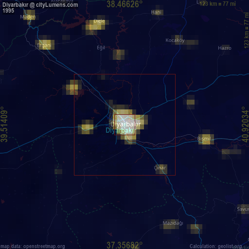
» NASA, Earths city lights 1995
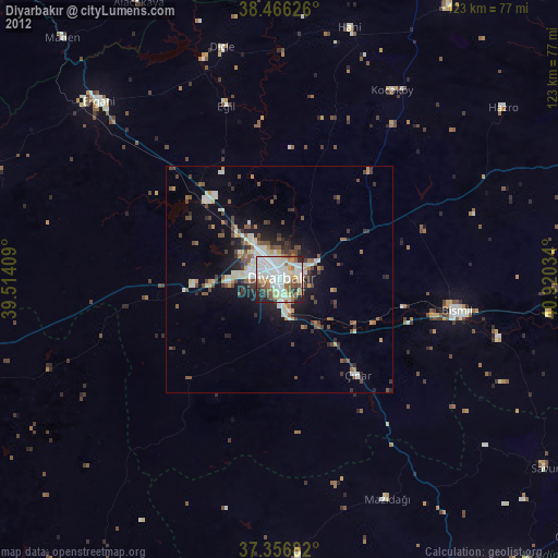
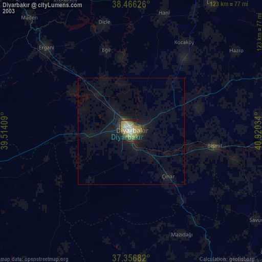
» NASA city lights 2003
» Earth at Night: Flat Maps 2012, 2016