Arıcak night lights from space
Night Light of Arıcak (Elazığ) from space (Turkey) Src. Average luminocity for 10x10km area is 1.8084% and for 50x50km: 2.7061%.
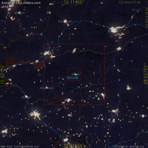
Analysis of Arıcak night lights 2016
Square area 10x10 km:
100  0%
0%
90-99 0%
80-89 0.49%
70-79 0.16%
60-69 0%
50-59 0.65%
40-49 1.3%
30-39 0%
20-29 0%
10-19 0.65%
0-9 96.75%
0%90-99
0%80-89
0.49%70-79
0.16%60-69
0%50-59
0.65%40-49
1.3%30-39
0%20-29
0%10-19
0.65%0-9
96.75%Square area 50x50 km:
100 0.06%
90-99 0.42%
80-89 0.48%
70-79 0.32%
60-69 0.25%
50-59 0.48%
40-49 0.66%
30-39 0.5%
20-29 0.42%
10-19 0.48%
0-9 95.91%
0.06%90-99
0.42%80-89
0.48%70-79
0.32%60-69
0.25%50-59
0.48%40-49
0.66%30-39
0.5%20-29
0.42%10-19
0.48%0-9
95.91%Clear (daylight) street map image can be seen on geolist.org.
Map coordinates:
39° 6' 39.9" North, 39° 25' 18" East
38° 33' 48.2" North, 40° 7' 29.3" East
38° 0' 41.4" North, 40° 49' 40.5" East
Some cities around Arıcak sort by population:
• Ergani
46 km =28.6 mi,  224°
224°
• Karakoçan
44 km =27.3 mi,  348°
348°
• Kovancılar
28.6 km =17.8 mi,  307°
307°
• Genç
42.5 km =26.4 mi,  61°
61°
• Dicle
22.6 km =14 mi,  193°
193°
• Palu
22.8 km =14.2 mi, 308°
• Hani
28.6 km =17.8 mi,  127°
127°
• Kocaköy
44.6 km =27.7 mi, 133°
323653 (p: 5,168)
Sources (retrieved 2019-11-25):
» Earth at Night: Flat Maps 2012, 2016