Dereli night lights from space
Night Light of Dereli (Giresun) from space (Turkey) Src. Average luminocity for 10x10km area is 5.9984% and for 50x50km: 4.8787%.
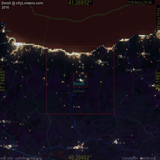
Analysis of Dereli night lights 2016
Square area 10x10 km:
 0%
0%90-99
1.62%80-89
0.32%70-79
0%60-69
0.32%50-59
0.97%40-49
1.62%30-39
2.92%20-29
1.95%10-19
1.95%0-9
88.31%Square area 50x50 km:
0.29%90-99
0.55%80-89
0.51%70-79
0.44%60-69
0.87%50-59
0.7%40-49
1.13%30-39
0.89%20-29
0.95%10-19
4.59%0-9
89.07%Clear (daylight) street map image can be seen on geolist.org.
Map coordinates:
41° 16' 10.3" North, 37° 44' 24.9" East
40° 44' 20" North, 38° 26' 36.1" East
40° 12' 14.5" North, 39° 8' 47.4" East
Some cities around Dereli sort by population:
• Ordu
53.6 km =33.3 mi,  299°
299°
• Giresun
20.4 km =12.7 mi,  346°
346°
• Şebin Karahisar
50.1 km =31.1 mi,  181°
181°
• Bulancak
28.4 km =17.6 mi,  321°
321°
• Tirebolu
43.1 km =26.8 mi,  46°
46°
• Espiye
31.8 km =19.8 mi,  43°
43°
• Keşap
19.7 km =12.2 mi,  14°
14°
• Piraziz
33.7 km =20.9 mi,  307°
307°
748240 (p: 8,473)
Sources (retrieved 2019-11-25):
» Earth at Night: Flat Maps 2012, 2016