Bulancak night lights from space
Night Light of Bulancak (Giresun) from space (Turkey) Src. Average luminocity for 10x10km area is 22.2041% and for 50x50km: 5.8211%.
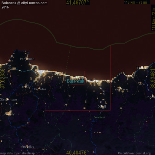

Analysis of Bulancak night lights 2016
Square area 10x10 km:
 1.02%
1.02%90-99
3.74%80-89
4.08%70-79
2.21%60-69
2.72%50-59
2.04%40-49
3.91%30-39
3.74%20-29
0.68%10-19
27.38%0-9
48.47%Square area 50x50 km:
0.33%90-99
0.66%80-89
0.79%70-79
0.51%60-69
0.9%50-59
0.62%40-49
1.06%30-39
1.07%20-29
1.04%10-19
6.68%0-9
86.33%Clear (daylight) street map image can be seen on geolist.org.
Map coordinates:
41° 28' 1.5" North, 37° 31' 42.1" East
40° 56' 17" North, 38° 13' 53.3" East
40° 24' 17.1" North, 38° 56' 4.6" East
Some cities around Bulancak sort by population:
• Ordu
29 km =18 mi,  278°
278°
• Giresun
13.3 km =8.3 mi,  100°
100°
• Espiye
39.6 km =24.6 mi,  88°
88°
• Perşembe
41.1 km =25.5 mi,  290°
290°
• Keşap
22.9 km =14.2 mi, 97°
• Piraziz
9.1 km =5.7 mi,  259°
259°
• Ulubey
40.9 km =25.4 mi, 259°
• Dereli
28.4 km =17.6 mi,  141°
141°
750317 (p: 43,635)
Sources (retrieved 2019-11-25):
» Earth at Night: Flat Maps 2012, 2016