Piraziz night lights from space
Night Light of Piraziz (Giresun) from space (Turkey) Src. Average luminocity for 10x10km area is 18.6173% and for 50x50km: 6.9544%.
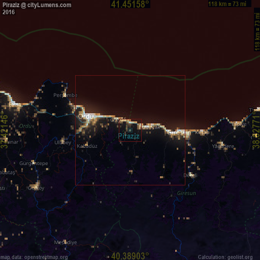
Analysis of Piraziz night lights 2016
Square area 10x10 km:
 0.51%
0.51%90-99
1.02%80-89
3.91%70-79
1.19%60-69
4.59%50-59
1.7%40-49
4.76%30-39
4.76%20-29
3.74%10-19
17.35%0-9
56.46%Square area 50x50 km:
0.55%90-99
0.9%80-89
0.92%70-79
0.73%60-69
1.08%50-59
0.63%40-49
0.99%30-39
1.23%20-29
1.9%10-19
7.67%0-9
83.4%Clear (daylight) street map image can be seen on geolist.org.
Map coordinates:
41° 27' 5.7" North, 37° 25' 17.3" East
40° 55' 20.8" North, 38° 7' 28.5" East
40° 23' 20.5" North, 38° 49' 39.8" East
Some cities around Piraziz sort by population:
• Ordu
20.6 km =12.8 mi,  287°
287°
• Giresun
22.1 km =13.7 mi,  91°
91°
• Bulancak
9.1 km =5.7 mi,  79°
79°
• Gürgentepe
47.5 km =29.5 mi,  251°
251°
• Perşembe
33.6 km =20.9 mi,  298°
298°
• Keşap
31.7 km =19.7 mi, 92°
• Ulubey
31.7 km =19.7 mi,  259°
259°
• Dereli
33.7 km =20.9 mi,  127°
127°
740561 (p: 9,959)
Sources (retrieved 2019-11-25):
» Earth at Night: Flat Maps 2012, 2016