Espiye night lights from space
Night Light of Espiye (Giresun) from space (Turkey) Src. Average luminocity for 10x10km area is 13.0663% and for 50x50km: 3.804%.
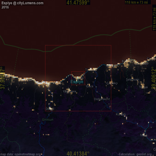
Analysis of Espiye night lights 2016
Square area 10x10 km:
 0.34%
0.34%90-99
0.51%80-89
0.51%70-79
2.55%60-69
3.06%50-59
3.57%40-49
3.4%30-39
3.23%20-29
1.19%10-19
2.21%0-9
79.42%Square area 50x50 km:
0.12%90-99
0.37%80-89
0.42%70-79
0.41%60-69
0.69%50-59
0.58%40-49
0.83%30-39
0.83%20-29
0.86%10-19
1.93%0-9
92.95%Clear (daylight) street map image can be seen on geolist.org.
Map coordinates:
41° 28' 33.6" North, 37° 59' 59.5" East
40° 56' 49.4" North, 38° 42' 10.8" East
40° 24' 49.8" North, 39° 24' 22" East
Some cities around Espiye sort by population:
• Giresun
26.7 km =16.6 mi,  262°
262°
• Bulancak
39.6 km =24.6 mi,  268°
268°
• Görele
26.9 km =16.7 mi,  69°
69°
• Tirebolu
11.4 km =7.1 mi,  54°
54°
• Eynesil
39.1 km =24.3 mi, 70°
• Şalpazarı
40.9 km =25.4 mi,  91°
91°
• Keşap
17.4 km =10.8 mi, 256°
• Dereli
31.8 km =19.8 mi,  223°
223°
831432 (p: 15,058)
Sources (retrieved 2019-11-25):
» Earth at Night: Flat Maps 2012, 2016