Denizli night lights from space
Night Light of Denizli from space (Turkey) Src. Average luminocity for 10x10km area is 89.3554% and for 50x50km: 19.8054%.
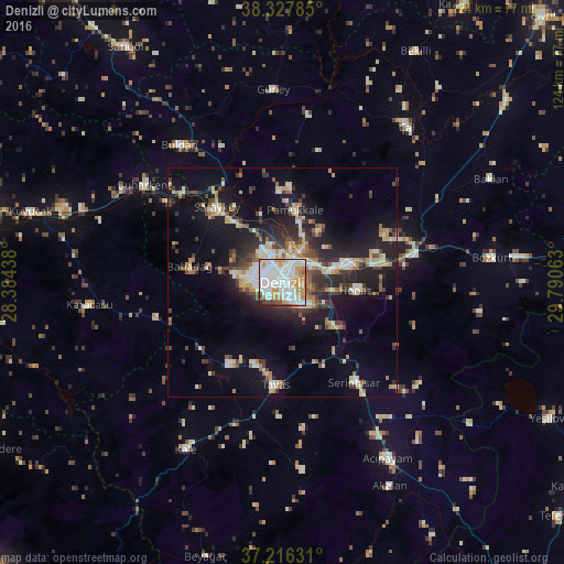
Analysis of Denizli night lights 2016
Square area 10x10 km:
 44.56%
90-99
23.13%80-89
5.61%70-79
14.63%60-69
5.44%50-59
2.55%40-49
3.23%30-39
0.17%20-29
0.68%10-19
0%0-9
0%Square area 50x50 km:
2.57%90-99
3.97%80-89
2.15%70-79
2.54%60-69
2.17%50-59
1.92%40-49
2.62%30-39
3.7%20-29
5.47%10-19
12.63%0-9
60.25%Clear (daylight) street map image can be seen on geolist.org.
Map coordinates:
38° 19' 40.3" North, 28° 23' 3.8" East
37° 46' 27" North, 29° 5' 15" East
37° 12' 58.7" North, 29° 47' 26.3" East
Some cities around Denizli sort by population:
• Merkezefendi
5.3 km =3.3 mi,  311°
311°
• Sarayköy
22 km =13.7 mi,  319°
319°
• Serinhisar
26.6 km =16.5 mi,  143°
143°
• Buldan
37.6 km =23.4 mi, 323°
• Tavas
22.4 km =13.9 mi,  183°
183°
• Pamukkale
16 km =9.9 mi,  9°
9°
• Honaz
16.1 km =10 mi,  96°
96°
• Buharkent
36.9 km =22.9 mi,  304°
304°
317109 (p: 313,238)
Sources (retrieved 2019-11-25):
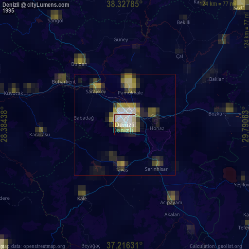
» NASA, Earths city lights 1995
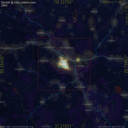
» NASA city lights 2003
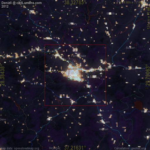
» Earth at Night: Flat Maps 2012, 2016