Bitlis night lights from space
Night Light of Bitlis from space (Turkey) Src. Average luminocity for 10x10km area is 30.5584% and for 50x50km: 4.8084%.
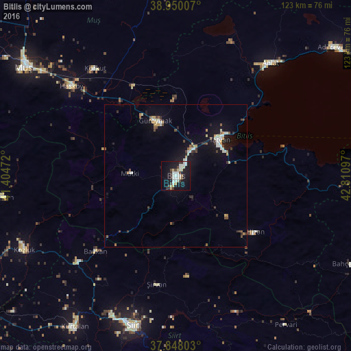
Analysis of Bitlis night lights 2016
Square area 10x10 km:
100  3.08%
3.08%
90-99 11.53%
80-89 4.22%
70-79 1.95%
60-69 0.32%
50-59 0.97%
40-49 4.22%
30-39 2.6%
20-29 3.9%
10-19 37.18%
0-9 30.03%
3.08%90-99
11.53%80-89
4.22%70-79
1.95%60-69
0.32%50-59
0.97%40-49
4.22%30-39
2.6%20-29
3.9%10-19
37.18%0-9
30.03%Square area 50x50 km:
100 0.36%
90-99 1.15%
80-89 0.51%
70-79 0.56%
60-69 0.24%
50-59 0.42%
40-49 0.74%
30-39 0.62%
20-29 0.5%
10-19 4.7%
0-9 90.2%
0.36%90-99
1.15%80-89
0.51%70-79
0.56%60-69
0.24%50-59
0.42%40-49
0.74%30-39
0.62%20-29
0.5%10-19
4.7%0-9
90.2%Clear (daylight) street map image can be seen on geolist.org.
Map coordinates:
38° 57' 0.3" North, 41° 24' 17" East
38° 24' 4.1" North, 42° 6' 28.2" East
37° 50' 52.9" North, 42° 48' 39.5" East
Some cities around Bitlis sort by population:
• Tatvan
18.3 km =11.4 mi,  56°
56°
• Ahlat
50.4 km =31.3 mi,  39°
39°
• Güroymak
21 km =13 mi,  337°
337°
• Hizan
33.4 km =20.8 mi,  125°
125°
• Baykan
39.8 km =24.7 mi,  227°
227°
• Korkut
46.5 km =28.9 mi,  322°
322°
• Şirvan
38.3 km =23.8 mi,  190°
190°
• Mutki
16.4 km =10.2 mi,  271°
271°
321025 (p: 46,111)
Sources (retrieved 2019-11-25):
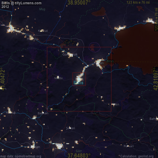
» Earth at Night: Flat Maps 2012, 2016