Mutki night lights from space
Night Light of Mutki (Bitlis) from space (Turkey) Src. Average luminocity for 10x10km area is 2.1802% and for 50x50km: 3.2951%.
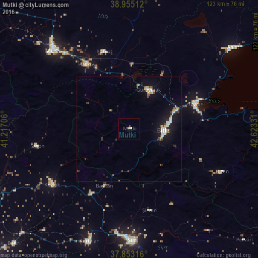
Analysis of Mutki night lights 2016
Square area 10x10 km:
100  0%
0%
90-99 1.3%
80-89 0%
70-79 0%
60-69 0.65%
50-59 0.49%
40-49 0.16%
30-39 0%
20-29 0%
10-19 0%
0-9 97.4%
0%90-99
1.3%80-89
0%70-79
0%60-69
0.65%50-59
0.49%40-49
0.16%30-39
0%20-29
0%10-19
0%0-9
97.4%Square area 50x50 km:
100 0.23%
90-99 0.75%
80-89 0.4%
70-79 0.38%
60-69 0.13%
50-59 0.25%
40-49 0.52%
30-39 0.46%
20-29 0.5%
10-19 3.03%
0-9 93.34%
0.23%90-99
0.75%80-89
0.4%70-79
0.38%60-69
0.13%50-59
0.25%40-49
0.52%30-39
0.46%20-29
0.5%10-19
3.03%0-9
93.34%Clear (daylight) street map image can be seen on geolist.org.
Map coordinates:
38° 57' 18.4" North, 41° 13' 1.4" East
38° 24' 22.5" North, 41° 55' 12.6" East
37° 51' 11.4" North, 42° 37' 23.9" East
Some cities around Mutki sort by population:
• Tatvan
33 km =20.5 mi,  73°
73°
• Bitlis
16.4 km =10.2 mi,  91°
91°
• Kozluk
45.4 km =28.2 mi,  238°
238°
• Güroymak
20.6 km =12.8 mi,  23°
23°
• Sason
45 km =28 mi,  258°
258°
• Baykan
30.5 km =19 mi,  204°
204°
• Korkut
38.3 km =23.8 mi,  341°
341°
• Şirvan
39.3 km =24.4 mi,  166°
166°
304009 (p: 5,510)
Sources (retrieved 2019-11-25):
» Earth at Night: Flat Maps 2012, 2016