Beypazarı night lights from space
Night Light of Beypazarı (Ankara) from space (Turkey) Src. Average luminocity for 10x10km area is 25.6786% and for 50x50km: 2.5503%.
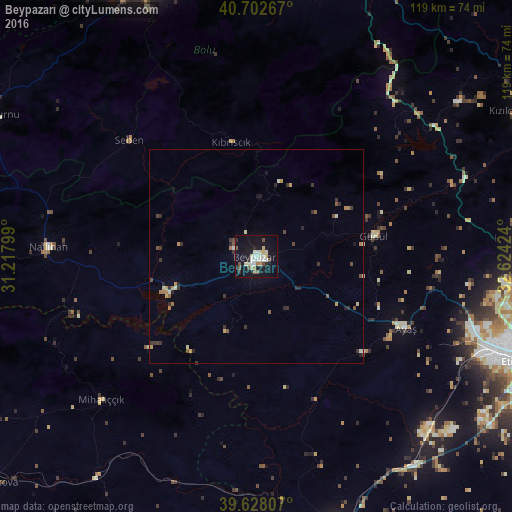

Analysis of Beypazarı night lights 2016
Square area 10x10 km:
100  4.38%
4.38%
90-99 4.71%
80-89 5.19%
70-79 1.14%
60-69 1.46%
50-59 2.6%
40-49 2.92%
30-39 0.32%
20-29 3.57%
10-19 32.47%
0-9 41.23%
4.38%90-99
4.71%80-89
5.19%70-79
1.14%60-69
1.46%50-59
2.6%40-49
2.92%30-39
0.32%20-29
3.57%10-19
32.47%0-9
41.23%Square area 50x50 km:
100 0.19%
90-99 0.39%
80-89 0.36%
70-79 0.28%
60-69 0.29%
50-59 0.33%
40-49 0.37%
30-39 0.52%
20-29 0.57%
10-19 1.51%
0-9 95.19%
0.19%90-99
0.39%80-89
0.36%70-79
0.28%60-69
0.29%50-59
0.33%40-49
0.37%30-39
0.52%20-29
0.57%10-19
1.51%0-9
95.19%Clear (daylight) street map image can be seen on geolist.org.
Map coordinates:
40° 42' 9.6" North, 31° 13' 4.8" East
40° 10' 3" North, 31° 55' 16" East
39° 37' 41.1" North, 32° 37' 27.3" East
Some cities around Beypazarı sort by population:
• Bolu
68.6 km =42.6 mi,  337°
337°
• Polatlı
68.3 km =42.4 mi,  164°
164°
• Kazan
65.2 km =40.5 mi,  83°
83°
• Nallıhan
48.4 km =30.1 mi,  272°
272°
• Çamlıdere
59 km =36.7 mi,  52°
52°
• Ayaş
38.7 km =24 mi,  115°
115°
• Yeniçağa
67.8 km =42.1 mi,  8°
8°
• Güdül
28 km =17.4 mi, 80°
750637 (p: 38,769)
Sources (retrieved 2019-11-25):
» Earth at Night: Flat Maps 2012, 2016