Nallıhan night lights from space
Night Light of Nallıhan (Ankara) from space (Turkey) Src. Average luminocity for 10x10km area is 8.0779% and for 50x50km: 0.715%.
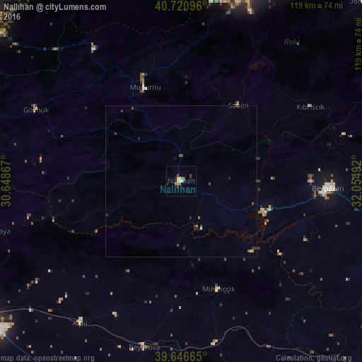
Analysis of Nallıhan night lights 2016
Square area 10x10 km:
 0.97%
0.97%90-99
0.97%80-89
0.65%70-79
0.65%60-69
2.27%50-59
0.65%40-49
1.95%30-39
1.3%20-29
1.62%10-19
0%0-9
88.96%Square area 50x50 km:
0.04%90-99
0.07%80-89
0.05%70-79
0.06%60-69
0.13%50-59
0.11%40-49
0.25%30-39
0.25%20-29
0.18%10-19
0.07%0-9
98.78%Clear (daylight) street map image can be seen on geolist.org.
Map coordinates:
40° 43' 15.5" North, 30° 38' 55.2" East
40° 11' 9.3" North, 31° 21' 6.4" East
39° 38' 47.9" North, 32° 3' 17.7" East
Some cities around Nallıhan sort by population:
• Bolu
64.8 km =40.3 mi,  19°
19°
• Düzce
74.3 km =46.2 mi,  347°
347°
• Beypazarı
48.4 km =30.1 mi,  92°
92°
• Mihalgazi
68.2 km =42.4 mi,  254°
254°
• Mudurnu
34.2 km =21.3 mi,  339°
339°
• Alpu
57.1 km =35.5 mi,  215°
215°
• Göynük
53.4 km =33.2 mi,  296°
296°
• Beylikova
56.9 km =35.4 mi,  192°
192°
741347 (p: 19,106)
Sources (retrieved 2019-11-25):
» Earth at Night: Flat Maps 2012, 2016