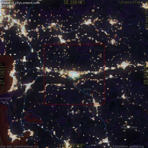
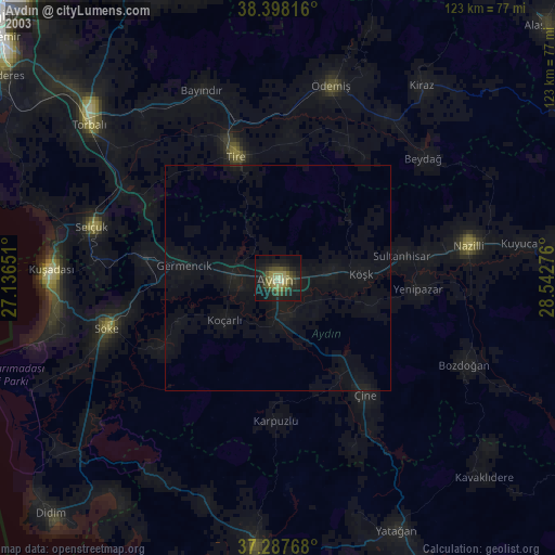
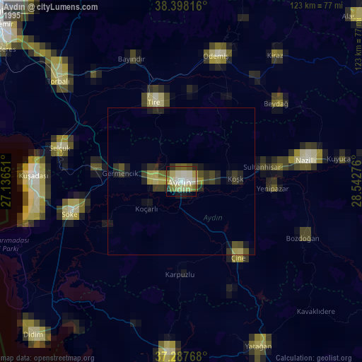
Aydın night lights from space
Night Light of Aydın from space (Turkey) Src. Average luminocity for 10x10km area is 62.3299% and for 50x50km: 13.7246%.
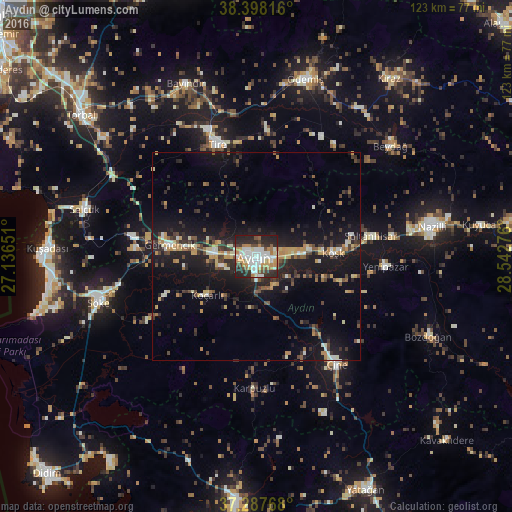
Analysis of Aydın night lights 2016
Square area 10x10 km:
 15.99%
90-99
15.99%80-89
5.27%70-79
9.35%60-69
8.5%50-59
4.25%40-49
6.8%30-39
4.93%20-29
25.34%10-19
3.57%0-9
0%Square area 50x50 km:
1.07%90-99
2%80-89
1.3%70-79
2.06%60-69
1.54%50-59
1.27%40-49
2.25%30-39
2.7%20-29
4.53%10-19
14.19%0-9
67.09%Clear (daylight) street map image can be seen on geolist.org.
Map coordinates:
38° 23' 53.4" North, 27° 8' 11.4" East
37° 50' 42" North, 27° 50' 22.7" East
37° 17' 15.6" North, 28° 32' 33.9" East
Some cities around Aydın sort by population:
• Tire
28.6 km =17.8 mi,  341°
341°
• İncirliova
10.2 km =6.3 mi,  274°
274°
• Germencik
21 km =13 mi,  277°
277°
• Acarlar
8.5 km =5.3 mi,  254°
254°
• Köşk
18.6 km =11.6 mi,  87°
87°
• Koçarlı
15 km =9.3 mi,  231°
231°
• Yenipazar
31.4 km =19.5 mi, 94°
• Sultanhisar
28.1 km =17.5 mi,  79°
79°
322830 (p: 163,022)
Sources (retrieved 2019-11-25):
» NASA, Earths city lights 1995
» NASA city lights 2003
» Earth at Night: Flat Maps 2012, 2016