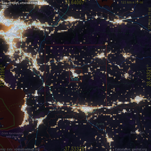
Tire night lights from space
Night Light of Tire (İzmir) from space (Turkey) Src. Average luminocity for 10x10km area is 34.375% and for 50x50km: 13.4461%.
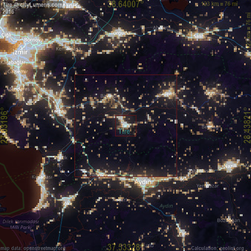
Analysis of Tire night lights 2016
Square area 10x10 km:
 5.36%
5.36%90-99
7.47%80-89
3.25%70-79
2.11%60-69
2.76%50-59
4.38%40-49
5.36%30-39
5.36%20-29
12.5%10-19
36.69%0-9
14.77%Square area 50x50 km:
0.67%90-99
1.82%80-89
1.11%70-79
1.36%60-69
1.78%50-59
1.66%40-49
2.27%30-39
2.89%20-29
4.15%10-19
15.47%0-9
66.83%Clear (daylight) street map image can be seen on geolist.org.
Map coordinates:
38° 38' 24.3" North, 27° 1' 55.1" East
38° 5' 19.6" North, 27° 44' 6.3" East
37° 31' 59.8" North, 28° 26' 17.6" East
Some cities around Tire sort by population:
• Aydın
28.6 km =17.8 mi,  161°
161°
• Ödemiş
25.7 km =16 mi,  52°
52°
• Torbalı
33.4 km =20.8 mi,  282°
282°
• Selçuk
35.6 km =22.1 mi,  244°
244°
• İncirliova
26.3 km =16.3 mi,  182°
182°
• Bayındır
16.2 km =10.1 mi,  331°
331°
• Germencik
26.9 km =16.7 mi,  205°
205°
• Acarlar
29.4 km =18.3 mi, 178°
299137 (p: 47,220)
Sources (retrieved 2019-11-25):
» Earth at Night: Flat Maps 2012, 2016